Sullivan night lights from space
Night Light of Sullivan (Missouri) from space (United States) Src. Average luminocity for 10x10km area is 20.5646% and for 50x50km: 3.019%.
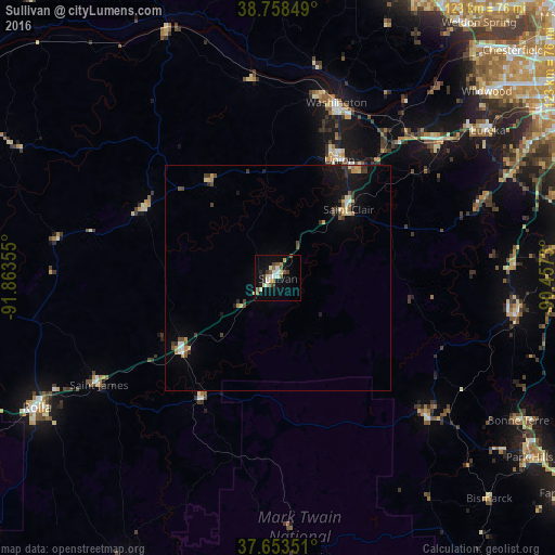
Analysis of Sullivan night lights 2016
Square area 10x10 km:
 2.55%
2.55%90-99
3.74%80-89
3.23%70-79
1.7%60-69
1.7%50-59
3.91%40-49
3.06%30-39
2.21%20-29
1.02%10-19
14.97%0-9
61.9%Square area 50x50 km:
0.23%90-99
0.28%80-89
0.54%70-79
0.37%60-69
0.23%50-59
0.35%40-49
0.54%30-39
0.65%20-29
0.23%10-19
2.35%0-9
94.24%Clear (daylight) street map image can be seen on geolist.org.
Map coordinates:
38° 45' 30.6" North, 91° 51' 48.8" West
38° 12' 29.2" North, 91° 9' 37.5" West
37° 39' 12.6" North, 90° 27' 26.3" West
Some cities around Sullivan sort by population:
• Wildwood
60.1 km =37.3 mi,  46°
46°
• Rolla
60.6 km =37.7 mi,  241°
241°
• Washington
41 km =25.5 mi,  18°
18°
• Union
30 km =18.6 mi,  26°
26°
• Eureka
56.8 km =35.3 mi, 54°
• Pacific
47.6 km =29.6 mi, 50°
• Bonne Terre
61.7 km =38.3 mi,  120°
120°
• De Soto
53.5 km =33.2 mi,  98°
98°
4410669 (p: 7,135)
Sources (retrieved 2019-11-25):
» Earth at Night: Flat Maps 2012, 2016