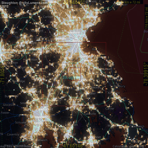
Stoughton night lights from space
Night Light of Stoughton (Massachusetts) from space (United States) Src. Average luminocity for 10x10km area is 64.6136% and for 50x50km: 49.8943%.
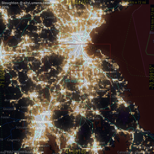
Analysis of Stoughton night lights 2016
Square area 10x10 km:
 8.64%
8.64%90-99
14.39%80-89
8.64%70-79
4.55%60-69
18.64%50-59
20.15%40-49
9.09%30-39
4.39%20-29
8.94%10-19
2.58%0-9
0%Square area 50x50 km:
8.38%90-99
8.73%80-89
5.76%70-79
5.73%60-69
8.63%50-59
10.23%40-49
9.65%30-39
8.85%20-29
14.1%10-19
12.34%0-9
7.59%Clear (daylight) street map image can be seen on geolist.org.
Map coordinates:
42° 38' 40" North, 71° 48' 19.4" West
42° 7' 30.4" North, 71° 6' 8.2" West
41° 36' 5.3" North, 70° 23' 56.9" West
Some cities around Stoughton sort by population:
• Brockton
8.3 km =5.2 mi,  123°
123°
• Braintree
12 km =7.5 mi,  43°
43°
• Randolph
6.5 km =4 mi,  50°
50°
• Norwood
11.1 km =6.9 mi,  313°
313°
• Easton
11.4 km =7.1 mi,  191°
191°
• Canton
5.1 km =3.2 mi,  316°
316°
• Holbrook
8.4 km =5.2 mi,  66°
66°
• Sharon
6.3 km =3.9 mi,  268°
268°
4952206 (p: 26,915)
Sources (retrieved 2019-11-25):
» Earth at Night: Flat Maps 2012, 2016