Canton night lights from space
Night Light of Canton (Massachusetts) from space (United States) Src. Average luminocity for 10x10km area is 65.1318% and for 50x50km: 52.8278%.
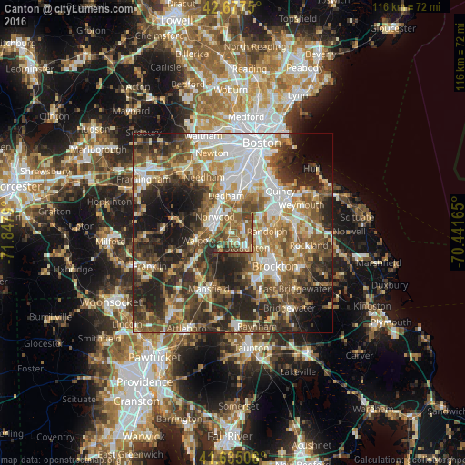

Analysis of Canton night lights 2016
Square area 10x10 km:
 9.55%
9.55%90-99
11.97%80-89
6.36%70-79
5.3%60-69
15.76%50-59
27.12%40-49
14.55%30-39
5.76%20-29
3.64%10-19
0%0-9
0%Square area 50x50 km:
10.65%90-99
9.48%80-89
5.8%70-79
5.81%60-69
8.44%50-59
10.15%40-49
9.9%30-39
9.28%20-29
14.5%10-19
10.47%0-9
5.51%Clear (daylight) street map image can be seen on geolist.org.
Map coordinates:
42° 40' 39" North, 71° 50' 52.4" West
42° 9' 30.3" North, 71° 8' 41.2" West
41° 38' 6.2" North, 70° 26' 29.9" West
Some cities around Canton sort by population:
• Randolph
8.6 km =5.3 mi,  86°
86°
• Norwood
6 km =3.7 mi,  311°
311°
• Stoughton
5.1 km =3.2 mi,  136°
136°
• Dedham
9.4 km =5.8 mi,  349°
349°
• Westwood
9 km =5.6 mi, 313°
• Holbrook
11.2 km =7 mi, 91°
• Walpole
8.8 km =5.5 mi,  257°
257°
• Sharon
4.8 km =3 mi,  215°
215°
4932214 (p: 21,679)
Sources (retrieved 2019-11-25):
» Earth at Night: Flat Maps 2012, 2016