Starkville night lights from space
Night Light of Starkville (Mississippi) from space (United States) Src. Average luminocity for 10x10km area is 64.5717% and for 50x50km: 9.3575%.
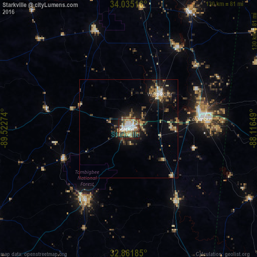

Analysis of Starkville night lights 2016
Square area 10x10 km:
 12.94%
90-99
17.66%80-89
9.44%70-79
9.79%60-69
7.52%50-59
5.07%40-49
10.49%30-39
6.99%20-29
15.73%10-19
4.37%0-9
0%Square area 50x50 km:
0.85%90-99
1.16%80-89
1.41%70-79
1.04%60-69
1.17%50-59
1.15%40-49
1.68%30-39
2.32%20-29
2.78%10-19
6.3%0-9
80.14%Clear (daylight) street map image can be seen on geolist.org.
Map coordinates:
34° 2' 6.6" North, 89° 31' 21.9" West
33° 27' 1.8" North, 88° 49' 10.6" West
32° 51' 42.7" North, 88° 6' 59.4" West
Some cities around Starkville sort by population:
• Columbus
36.7 km =22.8 mi,  82°
82°
• West Point
23.5 km =14.6 mi,  41°
41°
• Philadelphia
80.4 km =50 mi,  200°
200°
• Kosciusko
83.8 km =52.1 mi,  238°
238°
• Amory
66.8 km =41.5 mi,  27°
27°
• Louisville
42.4 km =26.3 mi,  211°
211°
• Pontotoc
90.2 km =56 mi,  349°
349°
• Aberdeen
48.9 km =30.4 mi, 31°
4447161 (p: 25,366)
Sources (retrieved 2019-11-25):
» Earth at Night: Flat Maps 2012, 2016