Columbus night lights from space
Night Light of Columbus (Mississippi) from space (United States) Src. Average luminocity for 10x10km area is 61.0604% and for 50x50km: 12.3797%.
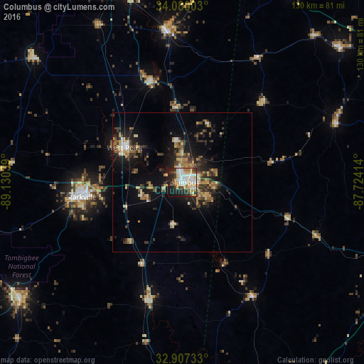
Analysis of Columbus night lights 2016
Square area 10x10 km:
 13.74%
90-99
17.03%80-89
11.17%70-79
6.23%60-69
6.04%50-59
3.11%40-49
6.96%30-39
7.14%20-29
15.02%10-19
13%0-9
0.55%Square area 50x50 km:
1.08%90-99
1.29%80-89
1.96%70-79
1.6%60-69
1.66%50-59
1.38%40-49
2.34%30-39
2.83%20-29
3.98%10-19
7.93%0-9
73.95%Clear (daylight) street map image can be seen on geolist.org.
Map coordinates:
34° 4' 48.1" North, 89° 7' 49.4" West
33° 29' 44.4" North, 88° 25' 38.1" West
32° 54' 26.4" North, 87° 43' 26.9" West
Some cities around Columbus sort by population:
• Tuscaloosa
85.8 km =53.3 mi,  111°
111°
• Starkville
36.7 km =22.8 mi,  262°
262°
• Northport
84.3 km =52.4 mi, 110°
• West Point
24.1 km =15 mi,  301°
301°
• Amory
54.6 km =33.9 mi,  354°
354°
• Hamilton
82.5 km =51.3 mi,  29°
29°
• Louisville
71.5 km =44.4 mi,  234°
234°
• Aberdeen
38.2 km =23.7 mi,  343°
343°
4422442 (p: 23,168)
Sources (retrieved 2019-11-25):
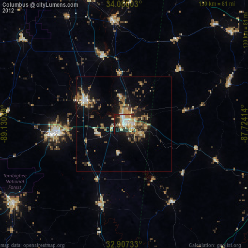
» Earth at Night: Flat Maps 2012, 2016