Stanton night lights from space
Night Light of Stanton (California) from space (United States) Src. Average luminocity for 10x10km area is 98.5245% and for 50x50km: 75.1268%.
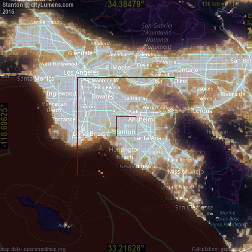

Analysis of Stanton night lights 2016
Square area 10x10 km:
 57.87%
90-99
39.34%80-89
1.75%70-79
1.05%60-69
0%50-59
0%40-49
0%30-39
0%20-29
0%10-19
0%0-9
0%Square area 50x50 km:
35.58%90-99
19.76%80-89
5.62%70-79
7.16%60-69
7.37%50-59
4.29%40-49
3.11%30-39
1.65%20-29
2.5%10-19
2.58%0-9
10.37%Clear (daylight) street map image can be seen on geolist.org.
Map coordinates:
34° 23' 5.2" North, 118° 41' 46.5" West
33° 48' 9.1" North, 117° 59' 35.2" West
33° 12' 58.5" North, 117° 17' 24" West
Some cities around Stanton sort by population:
• Garden Grove
5.7 km =3.5 mi,  123°
123°
• Westminster
5 km =3.1 mi,  194°
194°
• Buena Park
7.2 km =4.5 mi,  356°
356°
• Cypress
4.4 km =2.7 mi,  291°
291°
• La Palma
7 km =4.3 mi,  314°
314°
• Hawaiian Gardens
8 km =5 mi, 293°
• Los Alamitos
7.3 km =4.5 mi,  270°
270°
• Midway City
6.4 km =4 mi,  176°
176°
5398630 (p: 38,872)
Sources (retrieved 2019-11-25):
» Earth at Night: Flat Maps 2012, 2016