Springfield night lights from space
Night Light of Springfield (Massachusetts) from space (United States) Src. Average luminocity for 10x10km area is 87.6424% and for 50x50km: 26.2005%.
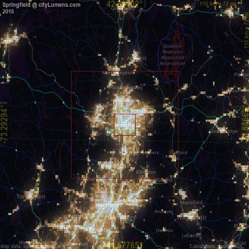
Analysis of Springfield night lights 2016
Square area 10x10 km:
 30.76%
90-99
27.42%80-89
12.88%70-79
11.67%60-69
10.91%50-59
6.21%40-49
0.15%30-39
0%20-29
0%10-19
0%0-9
0%Square area 50x50 km:
3.42%90-99
3.91%80-89
4.45%70-79
3.58%60-69
4%50-59
4.08%40-49
3.87%30-39
4.78%20-29
7.12%10-19
11.52%0-9
49.27%Clear (daylight) street map image can be seen on geolist.org.
Map coordinates:
42° 37' 15.7" North, 73° 17' 34.6" West
42° 6' 5.3" North, 72° 35' 23.3" West
41° 34' 39.5" North, 71° 53' 12.1" West
Some cities around Springfield sort by population:
• Chicopee
5.5 km =3.4 mi,  344°
344°
• North Chicopee
9.1 km =5.7 mi,  354°
354°
• Agawam
4.1 km =2.5 mi,  210°
210°
• West Springfield
2.6 km =1.6 mi,  283°
283°
• Ludlow
11.4 km =7.1 mi,  55°
55°
• Longmeadow
5.7 km =3.5 mi,  174°
174°
• East Longmeadow
7.6 km =4.7 mi,  122°
122°
• Sherwood Manor
10 km =6.2 mi, 167°
4951788 (p: 154,341)
Sources (retrieved 2019-11-25):
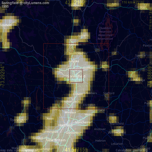
» NASA, Earths city lights 1995
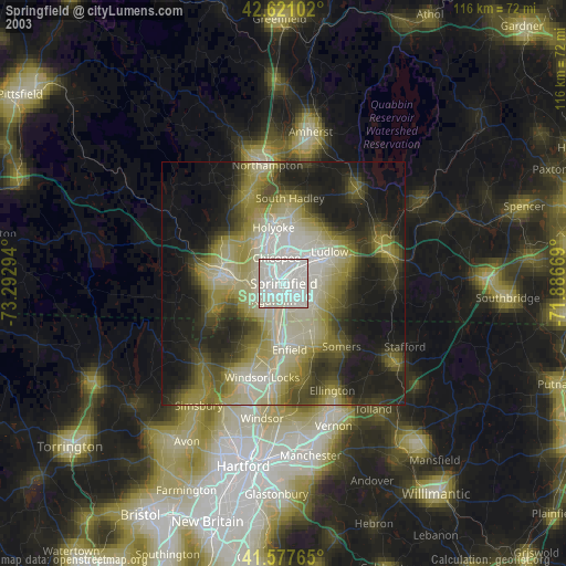
» NASA city lights 2003
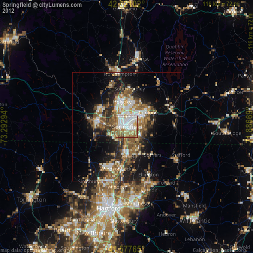
» Earth at Night: Flat Maps 2012, 2016