Chicopee night lights from space
Night Light of Chicopee (Massachusetts) from space (United States) Src. Average luminocity for 10x10km area is 84.9045% and for 50x50km: 24.3169%.
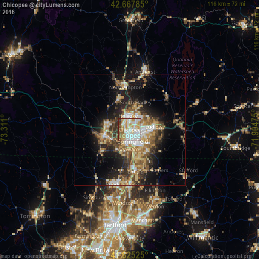
Analysis of Chicopee night lights 2016
Square area 10x10 km:
 29.55%
90-99
28.18%80-89
6.97%70-79
16.36%60-69
5.76%50-59
6.52%40-49
2.42%30-39
3.79%20-29
0.45%10-19
0%0-9
0%Square area 50x50 km:
3.33%90-99
3.81%80-89
3.98%70-79
3.42%60-69
3.74%50-59
3.61%40-49
3.6%30-39
4.29%20-29
5.7%10-19
11.48%0-9
53.03%Clear (daylight) street map image can be seen on geolist.org.
Map coordinates:
42° 40' 4.3" North, 73° 18' 39.6" West
42° 8' 55.3" North, 72° 36' 28.3" West
41° 37' 30.9" North, 71° 54' 17.1" West
Some cities around Chicopee sort by population:
• Springfield
5.5 km =3.4 mi,  164°
164°
• North Chicopee
3.9 km =2.4 mi,  10°
10°
• Westfield
12 km =7.5 mi,  257°
257°
• Holyoke
6.2 km =3.9 mi,  353°
353°
• Agawam
8.8 km =5.5 mi,  183°
183°
• West Springfield
4.7 km =2.9 mi,  192°
192°
• Ludlow
11 km =6.8 mi,  83°
83°
• Longmeadow
11.2 km =7 mi,  169°
169°
4933002 (p: 56,741)
Sources (retrieved 2019-11-25):
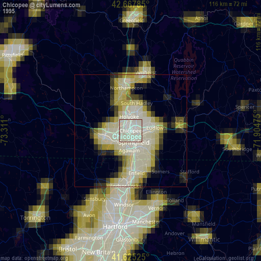
» NASA, Earths city lights 1995
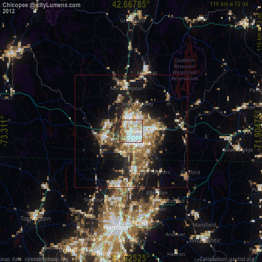
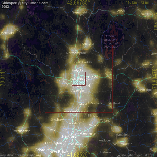
» NASA city lights 2003
» Earth at Night: Flat Maps 2012, 2016