East Longmeadow night lights from space
Night Light of East Longmeadow (Massachusetts) from space (United States) Src. Average luminocity for 10x10km area is 58.5492% and for 50x50km: 29.0963%.
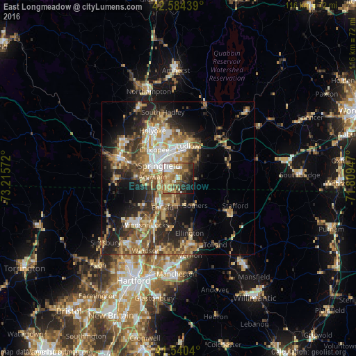
Analysis of East Longmeadow night lights 2016
Square area 10x10 km:
 6.51%
6.51%90-99
9.05%80-89
14.76%70-79
11.27%60-69
11.75%50-59
8.89%40-49
7.62%30-39
8.41%20-29
9.52%10-19
10.32%0-9
1.9%Square area 50x50 km:
3.5%90-99
4.26%80-89
5%70-79
4.07%60-69
4.9%50-59
5.13%40-49
4.4%30-39
5.35%20-29
7.79%10-19
10.73%0-9
44.87%Clear (daylight) street map image can be seen on geolist.org.
Map coordinates:
42° 35' 3.8" North, 73° 12' 56.6" West
42° 3' 52.3" North, 72° 30' 45.3" West
41° 32' 25.4" North, 71° 48' 34.1" West
Some cities around East Longmeadow sort by population:
• Springfield
7.6 km =4.7 mi,  302°
302°
• Agawam
8.5 km =5.3 mi,  273°
273°
• West Springfield
10.1 km =6.3 mi, 297°
• Ludlow
11 km =6.8 mi,  15°
15°
• Longmeadow
6 km =3.7 mi,  254°
254°
• Thompsonville
10.4 km =6.5 mi,  223°
223°
• Sherwood Manor
7.1 km =4.4 mi, 216°
• Hampden
8.2 km =5.1 mi,  90°
90°
4935434 (p: 15,102)
Sources (retrieved 2019-11-25):
» Earth at Night: Flat Maps 2012, 2016