East Garfield Park night lights from space
Night Light of East Garfield Park (Illinois) from space (United States) Src. Average luminocity for 10x10km area is 100% and for 50x50km: 66.9597%.
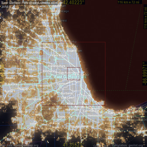
Analysis of East Garfield Park night lights 2016
Square area 10x10 km:
 100%
100%90-99
0%80-89
0%70-79
0%60-69
0%50-59
0%40-49
0%30-39
0%20-29
0%10-19
0%0-9
0%Square area 50x50 km:
39.33%90-99
15.5%80-89
5.84%70-79
3.09%60-69
2.26%50-59
2.26%40-49
2.19%30-39
1.68%20-29
2%10-19
2.75%0-9
23.11%Clear (daylight) street map image can be seen on geolist.org.
Map coordinates:
42° 24' 8" North, 88° 24' 21.5" West
41° 52' 51.1" North, 87° 42' 10.2" West
41° 21' 18.8" North, 86° 59' 59" West
Some cities around East Garfield Park sort by population:
• Chicago
5.6 km =3.5 mi,  128°
128°
• West Town
2.7 km =1.7 mi,  58°
58°
• South Lawndale
4.2 km =2.6 mi,  191°
191°
• Logan Square
4.7 km =2.9 mi,  3°
3°
• North Lawndale
2.7 km =1.7 mi,  209°
209°
• Lower West Side
4.3 km =2.7 mi, 133°
• Chicago Loop
5.8 km =3.6 mi,  86°
86°
• West Garfield Park
2.2 km =1.4 mi,  269°
269°
4890507 (p: 20,656)
Sources (retrieved 2019-11-25):
» Earth at Night: Flat Maps 2012, 2016