Greenbelt night lights from space
Night Light of Greenbelt (Maryland) from space (United States) Src. Average luminocity for 10x10km area is 84.3279% and for 50x50km: 74.5823%.
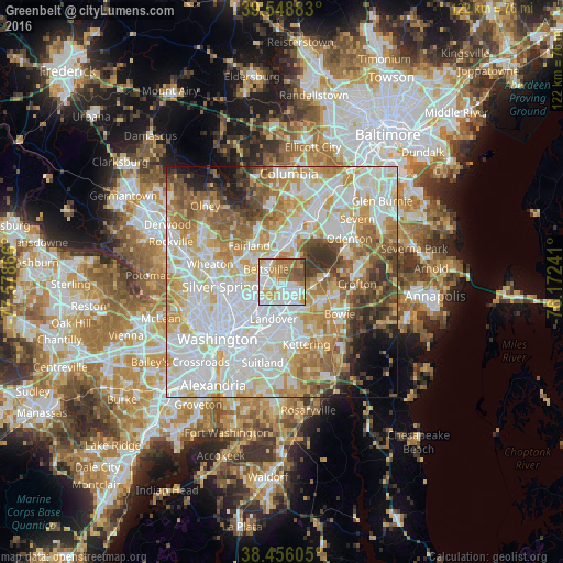
Analysis of Greenbelt night lights 2016
Square area 10x10 km:
 30.03%
90-99
23.86%80-89
7.95%70-79
14.61%60-69
10.55%50-59
9.74%40-49
2.92%30-39
0.32%20-29
0%10-19
0%0-9
0%Square area 50x50 km:
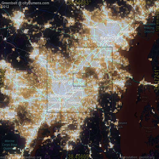
24.13%90-99
19.37%80-89
10.17%70-79
11.47%60-69
8.66%50-59
7.07%40-49
4.96%30-39
4.4%20-29
3.12%10-19
3.42%0-9
3.23%Clear (daylight) street map image can be seen on geolist.org.
Map coordinates:
39° 32' 55.8" North, 77° 34' 43.2" West
39° 0' 16.4" North, 76° 52' 31.9" West
38° 27' 21.8" North, 76° 10' 20.7" West
Some cities around Greenbelt sort by population:
• College Park
5.9 km =3.7 mi,  243°
243°
• Lanham-Seabrook
4.5 km =2.8 mi,  152°
152°
• Seabrook
4.8 km =3 mi, 148°
• Beltsville
4.4 km =2.7 mi,  320°
320°
• Glenn Dale
5.1 km =3.2 mi,  111°
111°
• New Carrollton
3.9 km =2.4 mi,  185°
185°
• Lanham
4.1 km =2.5 mi,  165°
165°
• Goddard
2.5 km =1.6 mi,  130°
130°
4356847 (p: 24,272)
Sources (retrieved 2019-11-25):
» Earth at Night: Flat Maps 2012, 2016