Snowflake night lights from space
Night Light of Snowflake (Arizona) from space (United States) Src. Average luminocity for 10x10km area is 8.8776% and for 50x50km: 0.5473%.
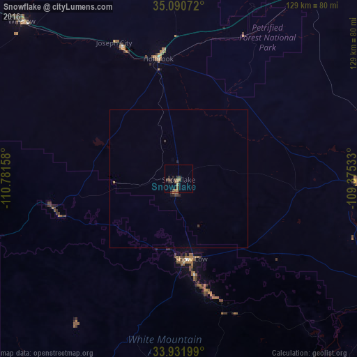
Analysis of Snowflake night lights 2016
Square area 10x10 km:
 0%
0%90-99
0%80-89
0%70-79
2.27%60-69
3.15%50-59
2.62%40-49
1.57%30-39
2.8%20-29
2.27%10-19
0.7%0-9
84.62%Square area 50x50 km:
0%90-99
0%80-89
0%70-79
0.13%60-69
0.15%50-59
0.11%40-49
0.1%30-39
0.2%20-29
0.18%10-19
0.06%0-9
99.07%Clear (daylight) street map image can be seen on geolist.org.
Map coordinates:
35° 5' 26.6" North, 110° 46' 53.7" West
34° 30' 48.1" North, 110° 4' 42.4" West
33° 55' 55.2" North, 109° 22' 31.2" West
Some cities around Snowflake sort by population:
• Payson
118.6 km =73.7 mi,  254°
254°
• Show Low
29.2 km =18.1 mi,  171°
171°
• Winslow
80.1 km =49.8 mi,  315°
315°
• Globe
140.5 km =87.3 mi,  207°
207°
• Big Park
156.9 km =97.5 mi,  280°
280°
• Zuni Pueblo
128.2 km =79.7 mi,  60°
60°
• Village of Oak Creek (Big Park)
156.9 km =97.5 mi, 280°
• Holbrook
43.8 km =27.2 mi,  350°
350°
5314943 (p: 5,666)
Sources (retrieved 2019-11-25):
» Earth at Night: Flat Maps 2012, 2016