Show Low night lights from space
Night Light of Show Low (Arizona) from space (United States) Src. Average luminocity for 10x10km area is 22.2418% and for 50x50km: 2.0724%.
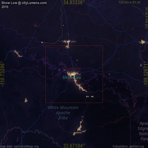
Analysis of Show Low night lights 2016
Square area 10x10 km:
 0.37%
0.37%90-99
1.1%80-89
0.92%70-79
3.66%60-69
8.42%50-59
7.33%40-49
3.3%30-39
2.75%20-29
2.01%10-19
19.78%0-9
50.37%Square area 50x50 km:
0.03%90-99
0.06%80-89
0.04%70-79
0.37%60-69
0.68%50-59
0.59%40-49
0.38%30-39
0.42%20-29
0.32%10-19
1.01%0-9
96.12%Clear (daylight) street map image can be seen on geolist.org.
Map coordinates:
34° 50' 0.1" North, 110° 43' 58.7" West
34° 15' 15.2" North, 110° 1' 47.4" West
33° 40' 15.7" North, 109° 19' 36.2" West
Some cities around Show Low sort by population:
• Payson
119.1 km =74 mi,  268°
268°
• Gold Camp
159 km =98.8 mi,  227°
227°
• Safford
160.7 km =99.9 mi,  169°
169°
• Winslow
105.2 km =65.4 mi,  324°
324°
• Globe
118.4 km =73.6 mi,  216°
216°
• Zuni Pueblo
141.1 km =87.7 mi,  49°
49°
• Snowflake
29.2 km =18.1 mi,  351°
351°
• Holbrook
73 km =45.4 mi, 350°
5314245 (p: 10,860)
Sources (retrieved 2019-11-25):
» Earth at Night: Flat Maps 2012, 2016