Sioux Falls night lights from space
Night Light of Sioux Falls (South Dakota) from space (United States) Src. Average luminocity for 10x10km area is 83.3127% and for 50x50km: 11.4787%.
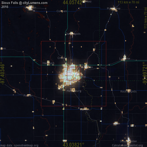
Analysis of Sioux Falls night lights 2016
Square area 10x10 km:
 26.83%
90-99
30.95%80-89
12.86%70-79
4.29%60-69
10.16%50-59
3.17%40-49
4.92%30-39
2.54%20-29
3.97%10-19
0.32%0-9
0%Square area 50x50 km:
2.19%90-99
2.69%80-89
1.61%70-79
1.16%60-69
1.35%50-59
0.99%40-49
1.28%30-39
1.36%20-29
2.84%10-19
4.96%0-9
79.57%Clear (daylight) street map image can be seen on geolist.org.
Map coordinates:
44° 3' 26.7" North, 97° 24' 12.5" West
43° 32' 59.9" North, 96° 42' 1.2" West
43° 2' 17.6" North, 95° 59' 50" West
Some cities around Sioux Falls sort by population:
• Brookings
85 km =52.8 mi,  354°
354°
• Worthington
89.3 km =55.5 mi,  84°
84°
• Vermillion
87.7 km =54.5 mi,  192°
192°
• Brandon
11.5 km =7.1 mi,  64°
64°
• Madison
60.6 km =37.7 mi,  326°
326°
• Orange City
79.6 km =49.5 mi,  139°
139°
• Harrisburg
13.2 km =8.2 mi,  178°
178°
• Sheldon
79.6 km =49.5 mi,  121°
121°
5231851 (p: 171,544)
Sources (retrieved 2019-11-25):
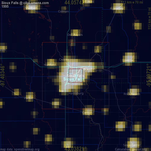
» NASA, Earths city lights 1995
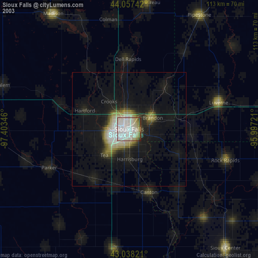
» NASA city lights 2003
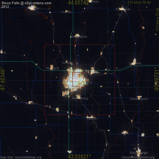
» Earth at Night: Flat Maps 2012, 2016