Orange City night lights from space
Night Light of Orange City (Iowa) from space (United States) Src. Average luminocity for 10x10km area is 15.6937% and for 50x50km: 3.467%.
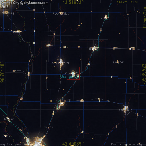
Analysis of Orange City night lights 2016
Square area 10x10 km:
 2.38%
2.38%90-99
2.06%80-89
2.54%70-79
0.63%60-69
2.86%50-59
0.63%40-49
3.33%30-39
2.06%20-29
3.02%10-19
2.7%0-9
77.78%Square area 50x50 km:
0.33%90-99
0.61%80-89
0.49%70-79
0.2%60-69
0.55%50-59
0.42%40-49
0.46%30-39
0.69%20-29
0.51%10-19
0.94%0-9
94.8%Clear (daylight) street map image can be seen on geolist.org.
Map coordinates:
43° 31' 9.2" North, 96° 45' 41.3" West
43° 0' 26" North, 96° 3' 30.1" West
42° 29' 27.2" North, 95° 21' 18.8" West
Some cities around Orange City sort by population:
• Sioux City
62.9 km =39.1 mi,  206°
206°
• South Sioux City
66 km =41 mi, 206°
• Vermillion
75.3 km =46.8 mi,  250°
250°
• Le Mars
25.2 km =15.7 mi,  200°
200°
• Sioux Center
12.5 km =7.8 mi,  310°
310°
• Harrisburg
70 km =43.5 mi, 312°
• Sheldon
25.4 km =15.8 mi,  40°
40°
• Cherokee
50.3 km =31.3 mi,  124°
124°
4870083 (p: 6,198)
Sources (retrieved 2019-11-25):
» Earth at Night: Flat Maps 2012, 2016