Silver Spring night lights from space
Night Light of Silver Spring (Maryland) from space (United States) Src. Average luminocity for 10x10km area is 96.2208% and for 50x50km: 79.4817%.
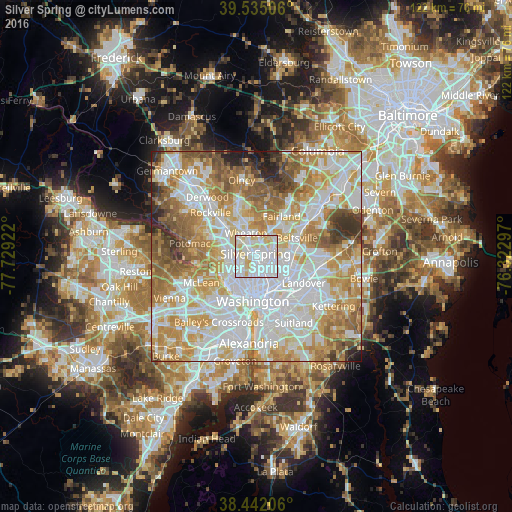
Analysis of Silver Spring night lights 2016
Square area 10x10 km:
 50.97%
90-99
30.68%80-89
17.05%70-79
1.3%60-69
0%50-59
0%40-49
0%30-39
0%20-29
0%10-19
0%0-9
0%Square area 50x50 km:
25.65%90-99
19.89%80-89
11.13%70-79
13.56%60-69
10.67%50-59
8.02%40-49
4.21%30-39
3.23%20-29
2.53%10-19
1.12%0-9
0%Clear (daylight) street map image can be seen on geolist.org.
Map coordinates:
39° 32' 6.2" North, 77° 43' 45.2" West
38° 59' 26.4" North, 77° 1' 33.9" West
38° 26' 31.4" North, 76° 19' 22.7" West
Some cities around Silver Spring sort by population:
• Chillum
4.3 km =2.7 mi,  134°
134°
• Langley Park
3.9 km =2.4 mi,  93°
93°
• Takoma Park
2.1 km =1.3 mi, 131°
• Adelphi
4.9 km =3 mi,  73°
73°
• Chevy Chase
4.7 km =2.9 mi,  230°
230°
• Chevy Chase
4.1 km =2.5 mi,  289°
289°
• Four Corners
3.5 km =2.2 mi,  19°
19°
• Forest Glen
3.6 km =2.2 mi,  317°
317°
4369596 (p: 71,452)
Sources (retrieved 2019-11-25):
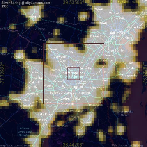
» NASA, Earths city lights 1995
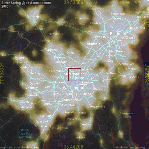
» NASA city lights 2003
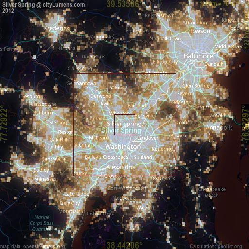
» Earth at Night: Flat Maps 2012, 2016