Forest Glen night lights from space
Night Light of Forest Glen (Maryland) from space (United States) Src. Average luminocity for 10x10km area is 93.7159% and for 50x50km: 76.6359%.
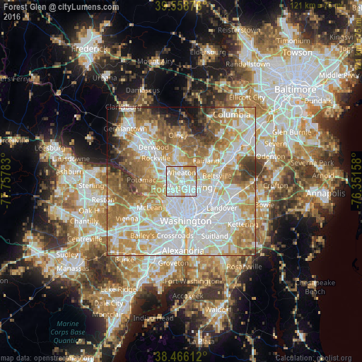
Analysis of Forest Glen night lights 2016
Square area 10x10 km:
 37.34%
90-99
33.6%80-89
20.78%70-79
6.17%60-69
2.11%50-59
0%40-49
0%30-39
0%20-29
0%10-19
0%0-9
0%Square area 50x50 km:
24.59%90-99
18.91%80-89
10.19%70-79
12.76%60-69
10.7%50-59
8.22%40-49
4.11%30-39
3.19%20-29
3.2%10-19
3.17%0-9
0.96%Clear (daylight) street map image can be seen on geolist.org.
Map coordinates:
39° 33' 31.5" North, 77° 45' 28.2" West
39° 0' 52.4" North, 77° 3' 16.9" West
38° 27' 58" North, 76° 21' 5.7" West
Some cities around Forest Glen sort by population:
• Silver Spring
3.6 km =2.2 mi,  137°
137°
• Wheaton
2.8 km =1.7 mi,  359°
359°
• Glenmont
4.8 km =3 mi,  5°
5°
• Kemp Mill
4.1 km =2.5 mi,  48°
48°
• Chevy Chase
1.9 km =1.2 mi,  227°
227°
• North Kensington
2.3 km =1.4 mi,  318°
318°
• South Kensington
2.2 km =1.4 mi,  282°
282°
• Four Corners
3.7 km =2.3 mi,  79°
79°
4355214 (p: 6,582)
Sources (retrieved 2019-11-25):
» Earth at Night: Flat Maps 2012, 2016