Shreveport night lights from space
Night Light of Shreveport (Louisiana) from space (United States) Src. Average luminocity for 10x10km area is 91.304% and for 50x50km: 28.8106%.
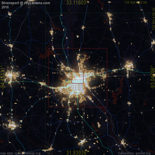
Analysis of Shreveport night lights 2016
Square area 10x10 km:
 42.31%
90-99
28.39%80-89
8.42%70-79
10.62%60-69
7.51%50-59
1.65%40-49
0.73%30-39
0.37%20-29
0%10-19
0%0-9
0%Square area 50x50 km:
5.01%90-99
4.68%80-89
3.8%70-79
4.42%60-69
4.05%50-59
4.48%40-49
3.46%30-39
5.71%20-29
6.11%10-19
12.35%0-9
45.92%Clear (daylight) street map image can be seen on geolist.org.
Map coordinates:
33° 6' 57.7" North, 94° 27' 11.9" West
32° 31' 30.5" North, 93° 45' 0.6" West
31° 55' 49.3" North, 93° 2' 49.4" West
Some cities around Shreveport sort by population:
• Bossier City
2 km =1.2 mi,  121°
121°
• Marshall
57.9 km =36 mi,  272°
272°
• Minden
44.6 km =27.7 mi,  76°
76°
• Carthage
68.7 km =42.7 mi,  233°
233°
• Red Chute
13.3 km =8.3 mi, 75°
• Atlanta
76 km =47.2 mi,  329°
329°
• Center
90.6 km =56.3 mi,  206°
206°
• Springhill
59.7 km =37.1 mi,  26°
26°
4341513 (p: 197,204)
Sources (retrieved 2019-11-25):
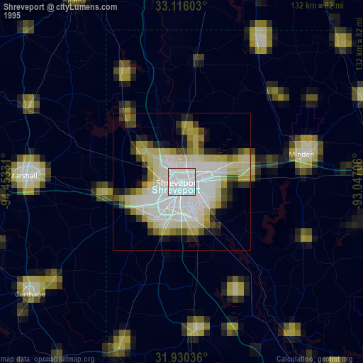
» NASA, Earths city lights 1995
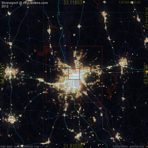
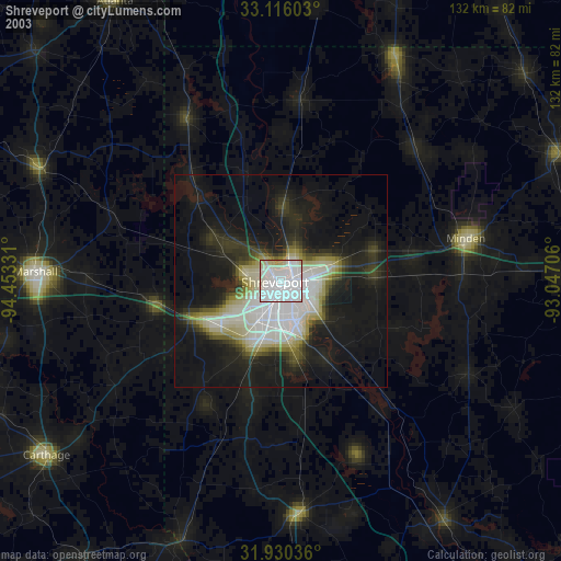
» NASA city lights 2003
» Earth at Night: Flat Maps 2012, 2016