Atlanta night lights from space
Night Light of Atlanta (Texas) from space (United States) Src. Average luminocity for 10x10km area is 25.8901% and for 50x50km: 2.415%.
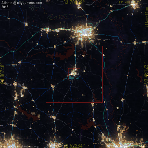
Analysis of Atlanta night lights 2016
Square area 10x10 km:
 1.1%
1.1%90-99
3.85%80-89
6.78%70-79
2.93%60-69
2.93%50-59
3.85%40-49
3.3%30-39
4.58%20-29
1.83%10-19
25.09%0-9
43.77%Square area 50x50 km:
0.06%90-99
0.19%80-89
0.51%70-79
0.2%60-69
0.24%50-59
0.43%40-49
0.35%30-39
0.61%20-29
0.61%10-19
1.44%0-9
95.36%Clear (daylight) street map image can be seen on geolist.org.
Map coordinates:
33° 42' 2.5" North, 94° 52' 2.9" West
33° 6' 49.5" North, 94° 9' 51.7" West
32° 31' 22.2" North, 93° 27' 40.4" West
Some cities around Atlanta sort by population:
• Shreveport
76 km =47.2 mi,  149°
149°
• Bossier City
77.8 km =48.3 mi, 148°
• Texarkana
36.3 km =22.6 mi,  17°
17°
• Texarkana
38.3 km =23.8 mi, 17°
• Marshall
66 km =41 mi,  196°
196°
• Mount Pleasant
75 km =46.6 mi,  273°
273°
• Wake Village
35.2 km =21.9 mi,  8°
8°
• Springhill
66.1 km =41.1 mi,  100°
100°
4671576 (p: 5,605)
Sources (retrieved 2019-11-25):
» Earth at Night: Flat Maps 2012, 2016