Center night lights from space
Night Light of Center (Texas) from space (United States) Src. Average luminocity for 10x10km area is 27.6282% and for 50x50km: 2.2688%.
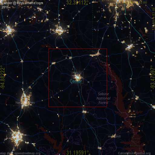
Analysis of Center night lights 2016
Square area 10x10 km:
 2.38%
2.38%90-99
2.38%80-89
2.56%70-79
3.85%60-69
5.86%50-59
5.68%40-49
5.86%30-39
6.78%20-29
2.75%10-19
24.73%0-9
37.18%Square area 50x50 km:
0.09%90-99
0.12%80-89
0.23%70-79
0.38%60-69
0.41%50-59
0.53%40-49
0.42%30-39
0.73%20-29
0.3%10-19
1.09%0-9
95.7%Clear (daylight) street map image can be seen on geolist.org.
Map coordinates:
32° 23' 28" North, 94° 52' 56" West
31° 47' 43.6" North, 94° 10' 44.7" West
31° 11' 45.3" North, 93° 28' 33.5" West
Some cities around Center sort by population:
• Shreveport
90.6 km =56.3 mi,  26°
26°
• Bossier City
90.5 km =56.2 mi, 27°
• Lufkin
72.8 km =45.2 mi,  225°
225°
• Nacogdoches
49.9 km =31 mi,  244°
244°
• Marshall
85.2 km =52.9 mi,  347°
347°
• Henderson
70.7 km =43.9 mi,  304°
304°
• Carthage
42.9 km =26.7 mi,  339°
339°
• Diboll
88.5 km =55 mi,  220°
220°
4679988 (p: 5,211)
Sources (retrieved 2019-11-25):
» Earth at Night: Flat Maps 2012, 2016