Shorewood night lights from space
Night Light of Shorewood (Wisconsin) from space (United States) Src. Average luminocity for 10x10km area is 63.6924% and for 50x50km: 36.2075%.
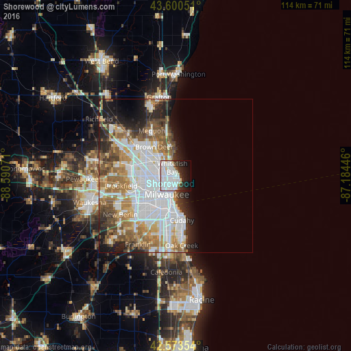
Analysis of Shorewood night lights 2016
Square area 10x10 km:
 36.21%
90-99
15.45%80-89
3.48%70-79
0.61%60-69
0.91%50-59
1.67%40-49
2.58%30-39
4.24%20-29
10%10-19
13.48%0-9
11.36%Square area 50x50 km:
13.18%90-99
7.04%80-89
2.87%70-79
3.58%60-69
5.16%50-59
4.85%40-49
3.82%30-39
2.87%20-29
5.17%10-19
6.23%0-9
45.25%Clear (daylight) street map image can be seen on geolist.org.
Map coordinates:
43° 36' 1.8" North, 88° 35' 26.6" West
43° 5' 21" North, 87° 53' 15.3" West
42° 34' 24.7" North, 87° 11' 4.1" West
Some cities around Shorewood sort by population:
• Milwaukee
5.8 km =3.6 mi,  195°
195°
• West Allis
12.6 km =7.8 mi,  230°
230°
• Wauwatosa
10.7 km =6.6 mi,  245°
245°
• Whitefish Bay
2.9 km =1.8 mi,  339°
339°
• Glendale
6.4 km =4 mi,  322°
322°
• Brown Deer
10.3 km =6.4 mi, 322°
• Saint Francis
13.6 km =8.5 mi,  176°
176°
• Fox Point
7.7 km =4.8 mi,  351°
351°
5273084 (p: 13,311)
Sources (retrieved 2019-11-25):
» Earth at Night: Flat Maps 2012, 2016