Glendale night lights from space
Night Light of Glendale (Wisconsin) from space (United States) Src. Average luminocity for 10x10km area is 79.3167% and for 50x50km: 37.4078%.
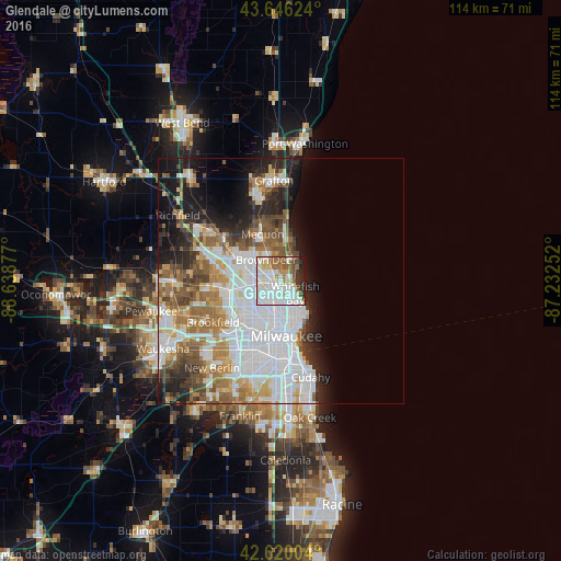
Analysis of Glendale night lights 2016
Square area 10x10 km:
 33.94%
90-99
22.58%80-89
7.58%70-79
4.39%60-69
5.15%50-59
10.3%40-49
3.48%30-39
4.39%20-29
5.15%10-19
3.03%0-9
0%Square area 50x50 km:
13.61%90-99
7.33%80-89
3.1%70-79
3.59%60-69
4.77%50-59
4.56%40-49
3.95%30-39
3.1%20-29
5.75%10-19
8.66%0-9
41.57%Clear (daylight) street map image can be seen on geolist.org.
Map coordinates:
43° 38' 46.5" North, 88° 38' 19.6" West
43° 8' 7" North, 87° 56' 8.3" West
42° 37' 12.1" North, 87° 13' 57.1" West
Some cities around Glendale sort by population:
• Milwaukee
11 km =6.8 mi,  167°
167°
• West Allis
14.4 km =8.9 mi,  203°
203°
• Wauwatosa
11.2 km =7 mi,  211°
211°
• Mequon
11.8 km =7.3 mi,  319°
319°
• Whitefish Bay
3.8 km =2.4 mi,  130°
130°
• Shorewood
6.4 km =4 mi,  142°
142°
• Brown Deer
3.9 km =2.4 mi, 323°
• Fox Point
3.7 km =2.3 mi,  48°
48°
5254404 (p: 12,870)
Sources (retrieved 2019-11-25):
» Earth at Night: Flat Maps 2012, 2016