Sheffield Lake night lights from space
Night Light of Sheffield Lake (Ohio) from space (United States) Src. Average luminocity for 10x10km area is 55.2126% and for 50x50km: 28.499%.
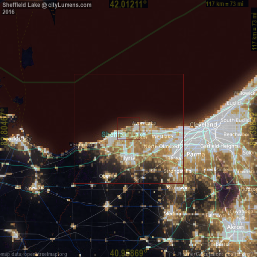
Analysis of Sheffield Lake night lights 2016
Square area 10x10 km:
 7.14%
7.14%90-99
14.46%80-89
9.01%70-79
6.29%60-69
16.5%50-59
5.95%40-49
1.87%30-39
1.87%20-29
16.84%10-19
15.99%0-9
4.08%Square area 50x50 km:
5.27%90-99
6.38%80-89
4.21%70-79
3.97%60-69
6.26%50-59
2.67%40-49
2.2%30-39
3.1%20-29
5.69%10-19
8.61%0-9
51.65%Clear (daylight) street map image can be seen on geolist.org.
Map coordinates:
42° 0' 43.6" North, 82° 48' 16.8" West
41° 29' 15.1" North, 82° 6' 5.5" West
40° 57' 31.3" North, 81° 23' 54.3" West
Some cities around Sheffield Lake sort by population:
• Lorain
7.8 km =4.8 mi,  240°
240°
• Elyria
13.3 km =8.3 mi,  182°
182°
• North Ridgeville
12.9 km =8 mi,  147°
147°
• Avon Lake
6.4 km =4 mi,  72°
72°
• Avon
6.8 km =4.2 mi,  125°
125°
• Avon Center
7.5 km =4.7 mi,  114°
114°
• Bay Village
15 km =9.3 mi,  91°
91°
• Amherst
14.2 km =8.8 mi,  225°
225°
5171856 (p: 9,026)
Sources (retrieved 2019-11-25):
» Earth at Night: Flat Maps 2012, 2016