Bay Village night lights from space
Night Light of Bay Village (Ohio) from space (United States) Src. Average luminocity for 10x10km area is 63.6207% and for 50x50km: 40.8764%.
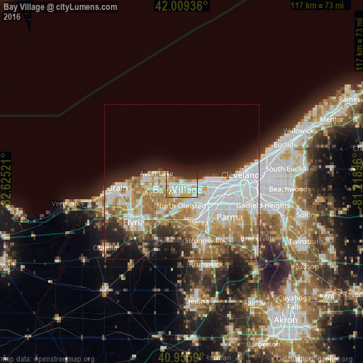
Analysis of Bay Village night lights 2016
Square area 10x10 km:
 15.48%
90-99
16.16%80-89
11.73%70-79
11.56%60-69
7.31%50-59
1.02%40-49
1.7%30-39
6.97%20-29
17.35%10-19
10.71%0-9
0%Square area 50x50 km:
11.71%90-99
9.25%80-89
4.7%70-79
5.01%60-69
8.01%50-59
3.89%40-49
3.08%30-39
3.31%20-29
5.99%10-19
6.92%0-9
38.12%Clear (daylight) street map image can be seen on geolist.org.
Map coordinates:
42° 0' 33.7" North, 82° 37' 30.8" West
41° 29' 5.2" North, 81° 55' 19.5" West
40° 57' 21.2" North, 81° 13' 8.3" West
Some cities around Bay Village sort by population:
• Lakewood
10.3 km =6.4 mi,  91°
91°
• Westlake
3.3 km =2.1 mi,  173°
173°
• North Olmsted
7.7 km =4.8 mi,  180°
180°
• Avon Lake
9.1 km =5.7 mi,  284°
284°
• Avon
10.1 km =6.3 mi,  248°
248°
• Rocky River
7 km =4.3 mi,  98°
98°
• Fairview Park
6.8 km =4.2 mi,  135°
135°
• Avon Center
8.6 km =5.3 mi, 251°
5146675 (p: 15,402)
Sources (retrieved 2019-11-25):
» Earth at Night: Flat Maps 2012, 2016