Setauket-East Setauket night lights from space
Night Light of Setauket-East Setauket (New York) from space (United States) Src. Average luminocity for 10x10km area is 60.3146% and for 50x50km: 37.1721%.
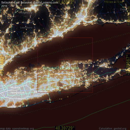
Analysis of Setauket-East Setauket night lights 2016
Square area 10x10 km:
 7.31%
7.31%90-99
10.03%80-89
6.97%70-79
13.44%60-69
16.5%50-59
15.99%40-49
6.12%30-39
4.25%20-29
9.52%10-19
8.84%0-9
1.02%Square area 50x50 km:
5.14%90-99
6.67%80-89
5.73%70-79
8.25%60-69
7.7%50-59
6.48%40-49
4.41%30-39
2.65%20-29
5.48%10-19
9.8%0-9
37.69%Clear (daylight) street map image can be seen on geolist.org.
Map coordinates:
41° 27' 35" North, 73° 48' 17.7" West
40° 55' 50.3" North, 73° 6' 6.4" West
40° 23' 50.2" North, 72° 23' 55.2" West
Some cities around Setauket-East Setauket sort by population:
• Centereach
8 km =5 mi,  178°
178°
• East Setauket
1.3 km =0.8 mi,  343°
343°
• Stony Brook
3.3 km =2.1 mi,  260°
260°
• Saint James
7.4 km =4.6 mi,  218°
218°
• Mount Sinai
6.3 km =3.9 mi,  73°
73°
• Terryville
3.9 km =2.4 mi,  127°
127°
• Port Jefferson
3.3 km =2.1 mi,  57°
57°
• Port Jefferson Station
4.6 km =2.9 mi,  97°
97°
7258965 (p: 15,477)
Sources (retrieved 2019-11-25):
» Earth at Night: Flat Maps 2012, 2016