Port Jefferson night lights from space
Night Light of Port Jefferson (New York) from space (United States) Src. Average luminocity for 10x10km area is 51.9728% and for 50x50km: 35.1529%.
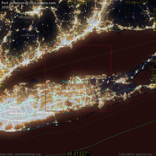
Analysis of Port Jefferson night lights 2016
Square area 10x10 km:
 7.31%
7.31%90-99
9.52%80-89
5.1%70-79
7.31%60-69
10.54%50-59
16.33%40-49
7.99%30-39
3.06%20-29
9.52%10-19
21.26%0-9
2.04%Square area 50x50 km:
4.82%90-99
6.19%80-89
5.35%70-79
7.48%60-69
7.18%50-59
6.31%40-49
4.58%30-39
3.02%20-29
5.11%10-19
9.62%0-9
40.34%Clear (daylight) street map image can be seen on geolist.org.
Map coordinates:
41° 28' 31.6" North, 73° 46' 20.6" West
40° 56' 47.4" North, 73° 4' 9.4" West
40° 24' 47.8" North, 72° 21' 58.1" West
Some cities around Port Jefferson sort by population:
• Selden
9.3 km =5.8 mi,  162°
162°
• East Setauket
3.1 km =1.9 mi,  259°
259°
• Setauket-East Setauket
3.3 km =2.1 mi,  237°
237°
• Stony Brook
6.5 km =4 mi,  248°
248°
• Miller Place
6.3 km =3.9 mi,  76°
76°
• Mount Sinai
3.3 km =2.1 mi,  88°
88°
• Terryville
4.2 km =2.6 mi,  175°
175°
• Sound Beach
8.6 km =5.3 mi, 82°
5132013 (p: 7,842)
Sources (retrieved 2019-11-25):
» Earth at Night: Flat Maps 2012, 2016