East Setauket night lights from space
Night Light of East Setauket (New York) from space (United States) Src. Average luminocity for 10x10km area is 50.585% and for 50x50km: 37.1748%.
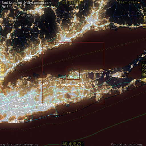
Analysis of East Setauket night lights 2016
Square area 10x10 km:
 6.46%
6.46%90-99
9.35%80-89
5.95%70-79
7.31%60-69
10.37%50-59
14.97%40-49
5.95%30-39
4.08%20-29
10.03%10-19
19.56%0-9
5.95%Square area 50x50 km:
5.04%90-99
6.52%80-89
5.79%70-79
8.39%60-69
7.7%50-59
6.6%40-49
4.57%30-39
2.84%20-29
5.35%10-19
9.46%0-9
37.75%Clear (daylight) street map image can be seen on geolist.org.
Map coordinates:
41° 28' 13.7" North, 73° 48' 32.7" West
40° 56' 29.4" North, 73° 6' 21.4" West
40° 24' 29.6" North, 72° 24' 10.2" West
Some cities around East Setauket sort by population:
• Centereach
9.3 km =5.8 mi,  176°
176°
• Setauket-East Setauket
1.3 km =0.8 mi,  163°
163°
• Stony Brook
3.4 km =2.1 mi,  239°
239°
• Saint James
8.2 km =5.1 mi,  211°
211°
• Mount Sinai
6.4 km =4 mi,  84°
84°
• Terryville
5 km =3.1 mi,  136°
136°
• Port Jefferson
3.1 km =1.9 mi, 79°
• Port Jefferson Station
5.2 km =3.2 mi,  109°
109°
5116060 (p: 17,006)
Sources (retrieved 2019-11-25):
» Earth at Night: Flat Maps 2012, 2016