Seneca Falls night lights from space
Night Light of Seneca Falls (New York) from space (United States) Src. Average luminocity for 10x10km area is 17.9381% and for 50x50km: 4.8047%.
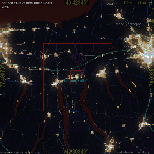
Analysis of Seneca Falls night lights 2016
Square area 10x10 km:
 1.43%
1.43%90-99
3.02%80-89
2.86%70-79
1.9%60-69
2.22%50-59
3.17%40-49
1.75%30-39
1.27%20-29
2.7%10-19
16.19%0-9
63.49%Square area 50x50 km:
0.47%90-99
0.63%80-89
0.6%70-79
0.47%60-69
0.54%50-59
0.87%40-49
0.69%30-39
0.7%20-29
0.64%10-19
3.44%0-9
90.94%Clear (daylight) street map image can be seen on geolist.org.
Map coordinates:
43° 25' 24.4" North, 77° 29' 59.1" West
42° 54' 38.2" North, 76° 47' 47.8" West
42° 23' 36.6" North, 76° 5' 36.6" West
Some cities around Seneca Falls sort by population:
• Auburn
18.9 km =11.7 mi,  82°
82°
• Geneva
15.5 km =9.6 mi,  252°
252°
• Canandaigua
40.2 km =25 mi,  264°
264°
• Newark
28.6 km =17.8 mi,  301°
301°
• Baldwinsville
46.7 km =29 mi,  53°
53°
• Centerport
22 km =13.7 mi, 48°
• Waterloo
5.4 km =3.4 mi, 263°
• Penn Yan
34.8 km =21.6 mi,  217°
217°
5137622 (p: 6,681)
Sources (retrieved 2019-11-25):
» Earth at Night: Flat Maps 2012, 2016