Baldwinsville night lights from space
Night Light of Baldwinsville (New York) from space (United States) Src. Average luminocity for 10x10km area is 29.8894% and for 50x50km: 17.2506%.
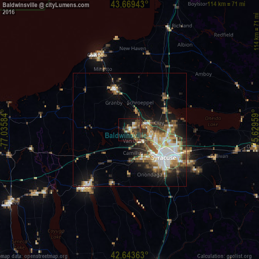
Analysis of Baldwinsville night lights 2016
Square area 10x10 km:
 1.36%
1.36%90-99
2.88%80-89
3.18%70-79
4.55%60-69
4.7%50-59
6.36%40-49
9.39%30-39
5.45%20-29
11.36%10-19
21.67%0-9
29.09%Square area 50x50 km:
2.92%90-99
3.18%80-89
1.98%70-79
2.16%60-69
2.1%50-59
2.68%40-49
3.06%30-39
2.7%20-29
3.8%10-19
7.62%0-9
67.79%Clear (daylight) street map image can be seen on geolist.org.
Map coordinates:
43° 40' 9.9" North, 77° 2' 9" West
43° 9' 31.2" North, 76° 19' 57.8" West
42° 38' 37.1" North, 75° 37' 46.5" West
Some cities around Baldwinsville sort by population:
• Syracuse
19.4 km =12.1 mi,  129°
129°
• Fulton
19.5 km =12.1 mi,  339°
339°
• Fairmount
14.6 km =9.1 mi,  148°
148°
• North Syracuse
16.7 km =10.4 mi,  99°
99°
• Mattydale
16.7 km =10.4 mi,  113°
113°
• Solvay
15.1 km =9.4 mi,  137°
137°
• Volney
20.6 km =12.8 mi,  354°
354°
• Centerport
24.8 km =15.4 mi,  238°
238°
5107785 (p: 7,770)
Sources (retrieved 2019-11-25):
» Earth at Night: Flat Maps 2012, 2016