Sedro-Woolley night lights from space
Night Light of Sedro-Woolley (Washington) from space (United States) Src. Average luminocity for 10x10km area is 12.5994% and for 50x50km: 3.8857%.
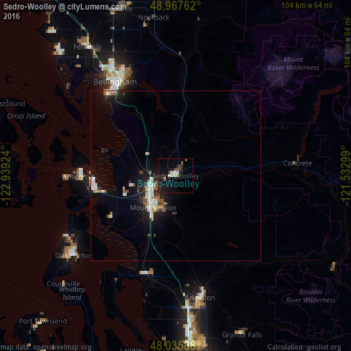
Analysis of Sedro-Woolley night lights 2016
Square area 10x10 km:
 1.99%
1.99%90-99
1.56%80-89
1.14%70-79
0.43%60-69
0.28%50-59
2.41%40-49
1.28%30-39
1.42%20-29
2.84%10-19
14.77%0-9
71.88%Square area 50x50 km:
0.74%90-99
0.68%80-89
0.23%70-79
0.25%60-69
0.44%50-59
0.51%40-49
0.28%30-39
0.47%20-29
0.91%10-19
3.64%0-9
91.85%Clear (daylight) street map image can be seen on geolist.org.
Map coordinates:
48° 58' 3.4" North, 122° 56' 21.3" West
48° 30' 14" North, 122° 14' 10" West
48° 2' 9.2" North, 121° 31' 58.8" West
Some cities around Sedro-Woolley sort by population:
• Bellingham
33.9 km =21.1 mi,  326°
326°
• Mount Vernon
11.7 km =7.3 mi,  218°
218°
• Oak Harbor
38.1 km =23.7 mi,  232°
232°
• Arlington
34.9 km =21.7 mi,  166°
166°
• Anacortes
27.8 km =17.3 mi,  271°
271°
• Burlington
7.3 km =4.5 mi,  244°
244°
• Stanwood
30.9 km =19.2 mi,  198°
198°
• Sudden Valley
25.7 km =16 mi,  341°
341°
5809902 (p: 10,815)
Sources (retrieved 2019-11-25):
» Earth at Night: Flat Maps 2012, 2016