Mount Vernon night lights from space
Night Light of Mount Vernon (Washington) from space (United States) Src. Average luminocity for 10x10km area is 37.6122% and for 50x50km: 5.153%.
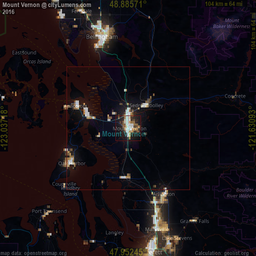
Analysis of Mount Vernon night lights 2016
Square area 10x10 km:
 7.39%
7.39%90-99
8.24%80-89
2.41%70-79
4.12%60-69
4.12%50-59
7.24%40-49
1.7%30-39
4.69%20-29
11.93%10-19
32.95%0-9
15.2%Square area 50x50 km:
0.91%90-99
0.85%80-89
0.37%70-79
0.34%60-69
0.63%50-59
0.73%40-49
0.51%30-39
0.56%20-29
0.9%10-19
4.57%0-9
89.62%Clear (daylight) street map image can be seen on geolist.org.
Map coordinates:
48° 53' 8.6" North, 123° 2' 13.8" West
48° 25' 16.4" North, 122° 20' 2.6" West
47° 57' 8.8" North, 121° 37' 51.3" West
Some cities around Mount Vernon sort by population:
• Oak Harbor
26.9 km =16.7 mi,  238°
238°
• Arlington
29.2 km =18.1 mi,  148°
148°
• Anacortes
22.9 km =14.2 mi,  296°
296°
• Camano
31 km =19.3 mi,  207°
207°
• Sedro-Woolley
11.7 km =7.3 mi,  38°
38°
• Burlington
6.1 km =3.8 mi,  5°
5°
• Stanwood
20.2 km =12.6 mi,  187°
187°
• Sudden Valley
33.6 km =20.9 mi,  358°
358°
5804127 (p: 34,053)
Sources (retrieved 2019-11-25):
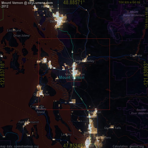
» Earth at Night: Flat Maps 2012, 2016