Bellingham night lights from space
Night Light of Bellingham (Washington) from space (United States) Src. Average luminocity for 10x10km area is 53.0554% and for 50x50km: 5.2355%.
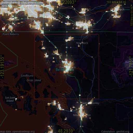
Analysis of Bellingham night lights 2016
Square area 10x10 km:
 13.92%
90-99
13.35%80-89
5.11%70-79
4.97%60-69
3.41%50-59
7.81%40-49
7.53%30-39
5.11%20-29
14.06%10-19
19.89%0-9
4.83%Square area 50x50 km:
0.8%90-99
0.9%80-89
0.37%70-79
0.43%60-69
0.41%50-59
0.75%40-49
0.73%30-39
0.65%20-29
1.12%10-19
3.69%0-9
90.16%Clear (daylight) street map image can be seen on geolist.org.
Map coordinates:
49° 13' 15.3" North, 123° 11' 28.9" West
48° 45' 34.4" North, 122° 29' 17.6" West
48° 17' 38" North, 121° 47' 6.4" West
Some cities around Bellingham sort by population:
• Anacortes
28.9 km =18 mi,  198°
198°
• Lynden
21 km =13 mi,  7°
7°
• Ferndale
12.3 km =7.6 mi,  322°
322°
• Aldergrove, CA
33.2 km =20.6 mi,  2°
2°
• Burlington
33.8 km =21 mi,  159°
159°
• Birch Bay
25.7 km =16 mi,  313°
313°
• Sudden Valley
11.2 km =7 mi,  111°
111°
• Blaine
32.2 km =20 mi, 323°
5786899 (p: 85,146)
Sources (retrieved 2019-11-25):
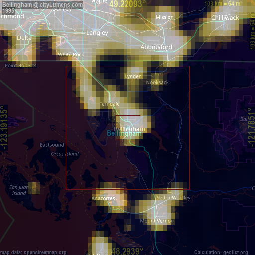
» NASA, Earths city lights 1995
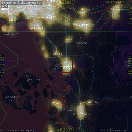
» NASA city lights 2003
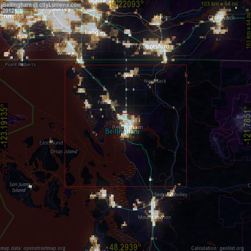
» Earth at Night: Flat Maps 2012, 2016