Grover Beach night lights from space
Night Light of Grover Beach (California) from space (United States) Src. Average luminocity for 10x10km area is 28.7028% and for 50x50km: 7.4519%.
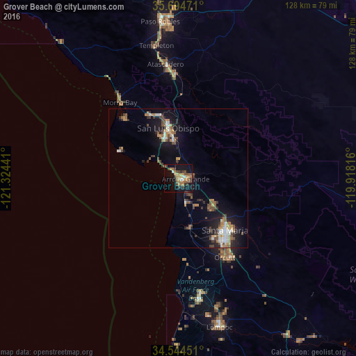
Analysis of Grover Beach night lights 2016
Square area 10x10 km:
 1.22%
1.22%90-99
2.27%80-89
2.8%70-79
5.24%60-69
8.22%50-59
4.55%40-49
6.64%30-39
5.77%20-29
1.75%10-19
33.74%0-9
27.8%Square area 50x50 km:
0.72%90-99
0.98%80-89
0.38%70-79
1.16%60-69
1.26%50-59
1.03%40-49
1.57%30-39
1.12%20-29
1.54%10-19
6.36%0-9
83.87%Clear (daylight) street map image can be seen on geolist.org.
Map coordinates:
35° 41' 41" North, 121° 19' 27.9" West
35° 7' 17.9" North, 120° 37' 16.6" West
34° 32' 40.2" North, 119° 55' 5.4" West
Some cities around Grover Beach sort by population:
• Santa Maria
25.2 km =15.7 mi,  137°
137°
• San Luis Obispo
18.2 km =11.3 mi,  348°
348°
• Arroyo Grande
2.8 km =1.7 mi,  96°
96°
• Nipomo
15.9 km =9.9 mi,  123°
123°
• Los Osos
28.5 km =17.7 mi,  317°
317°
• Pismo Beach
3 km =1.9 mi, 322°
• Guadalupe
17.3 km =10.7 mi,  164°
164°
• Oceano
2.7 km =1.7 mi, 162°
5354552 (p: 13,600)
Sources (retrieved 2019-11-25):
» Earth at Night: Flat Maps 2012, 2016