Canoga Park night lights from space
Night Light of Canoga Park (California) from space (United States) Src. Average luminocity for 10x10km area is 88.2344% and for 50x50km: 51.184%.
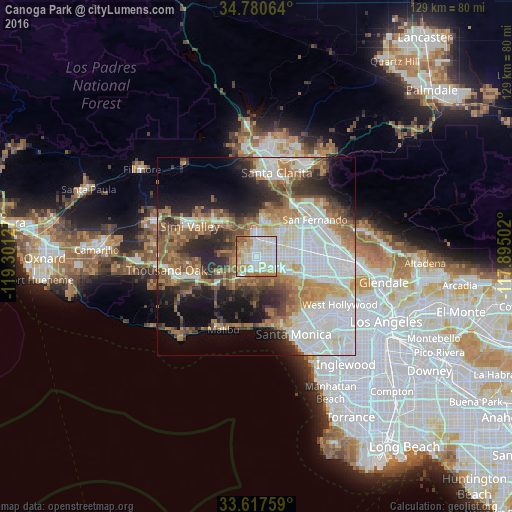
Analysis of Canoga Park night lights 2016
Square area 10x10 km:
 30.95%
90-99
26.92%80-89
14.29%70-79
13.92%60-69
10.99%50-59
2.56%40-49
0.37%30-39
0%20-29
0%10-19
0%0-9
0%Square area 50x50 km:
15.23%90-99
10.35%80-89
4.39%70-79
5.46%60-69
8.97%50-59
6.78%40-49
5.95%30-39
5.46%20-29
8.15%10-19
10.15%0-9
19.11%Clear (daylight) street map image can be seen on geolist.org.
Map coordinates:
34° 46' 50.3" North, 119° 18' 4.6" West
34° 12' 4" North, 118° 35' 53.3" West
33° 37' 3.3" North, 117° 53' 42.1" West
Some cities around Canoga Park sort by population:
• Woodland Hills
3.7 km =2.3 mi,  191°
191°
• Northridge
6.4 km =4 mi,  61°
61°
• North Hills
11.1 km =6.9 mi,  69°
69°
• Encino
10.1 km =6.3 mi,  117°
117°
• West Hills
4.2 km =2.6 mi,  264°
264°
• Chatsworth
6.2 km =3.9 mi,  357°
357°
• Calabasas
6.1 km =3.8 mi,  217°
217°
• Topanga
12 km =7.5 mi,  181°
181°
5333913 (p: 60,578)
Sources (retrieved 2019-11-25):
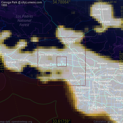
» NASA, Earths city lights 1995
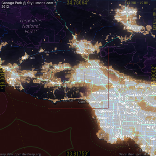
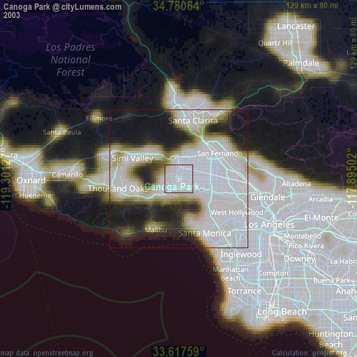
» NASA city lights 2003
» Earth at Night: Flat Maps 2012, 2016