San Jose night lights from space
Night Light of San Jose (California) from space (United States) Src. Average luminocity for 10x10km area is 98.0925% and for 50x50km: 34.1234%.
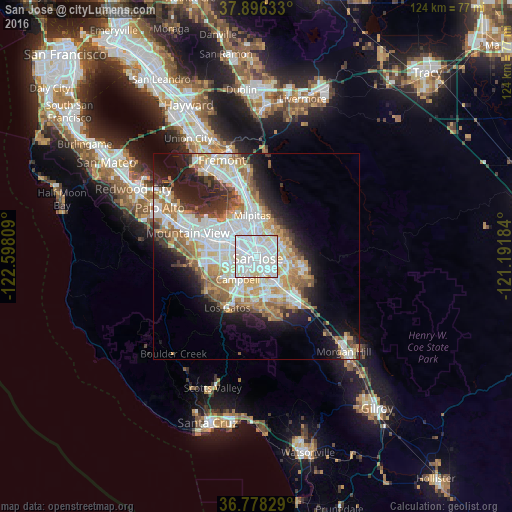
Analysis of San Jose night lights 2016
Square area 10x10 km:
 56.17%
90-99
37.18%80-89
6.01%70-79
0.65%60-69
0%50-59
0%40-49
0%30-39
0%20-29
0%10-19
0%0-9
0%Square area 50x50 km:
9.61%90-99
8.31%80-89
2.81%70-79
4.76%60-69
4.86%50-59
3.64%40-49
2.59%30-39
2.88%20-29
5.49%10-19
9.56%0-9
45.5%Clear (daylight) street map image can be seen on geolist.org.
Map coordinates:
37° 53' 46.8" North, 122° 35' 53.1" West
37° 20' 21.8" North, 121° 53' 41.9" West
36° 46' 41.8" North, 121° 11' 30.6" West
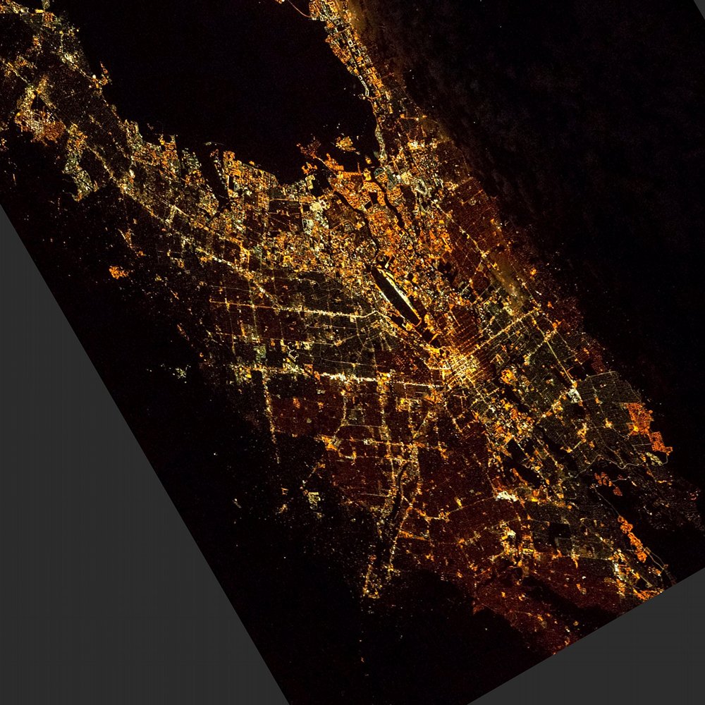
Fantastic image of San Jose from space taken by astronauts [src2], but I don't have information about it's orientation, scale or angle. If necessary, it was rotated manually, so North points approximately to upper direction. Click to zoom in:
Some cities around San Jose sort by population:
• Sunnyvale
12.9 km =8 mi,  284°
284°
• Santa Clara
5.6 km =3.5 mi,  287°
287°
• Milpitas
9.9 km =6.2 mi,  354°
354°
• Cupertino
12.3 km =7.6 mi,  261°
261°
• Campbell
7.6 km =4.7 mi,  219°
219°
• Saratoga
14.1 km =8.8 mi,  233°
233°
• Alum Rock
6.7 km =4.2 mi,  63°
63°
• East Foothills
8.3 km =5.2 mi, 55°
5392171 (p: 1,026,908)
Sources (retrieved 2019-11-25):
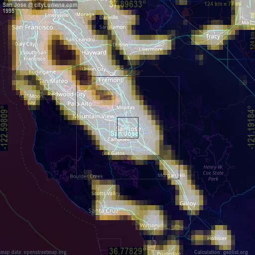
» NASA, Earths city lights 1995
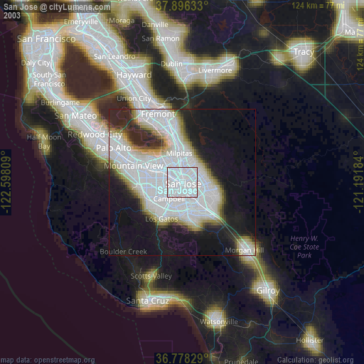
» NASA city lights 2003
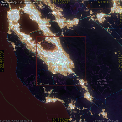
» Earth at Night: Flat Maps 2012, 2016
Src.2: Tim Kopra, Twitter/@astro_tim, 2018-05-11