Sandy night lights from space
Night Light of Sandy (Utah) from space (United States) Src. Average luminocity for 10x10km area is 96.5292% and for 50x50km: 37.2822%.
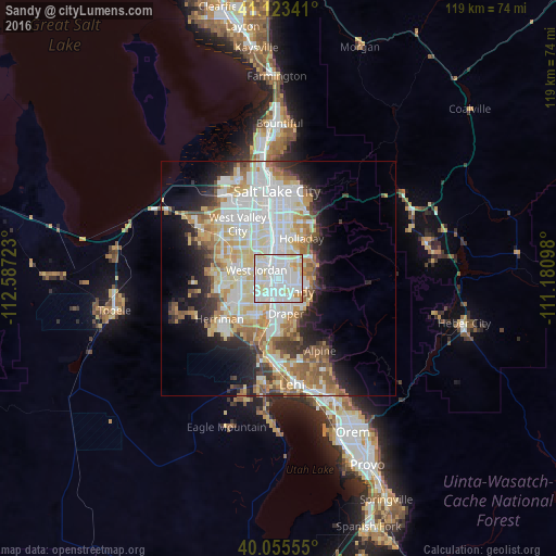
Analysis of Sandy night lights 2016
Square area 10x10 km:
 46.92%
90-99
39.77%80-89
9.9%70-79
2.6%60-69
0.81%50-59
0%40-49
0%30-39
0%20-29
0%10-19
0%0-9
0%Square area 50x50 km:
9.73%90-99
9.4%80-89
5.83%70-79
4.28%60-69
4.46%50-59
3.98%40-49
2.65%30-39
2.88%20-29
5.56%10-19
8.11%0-9
43.13%Clear (daylight) street map image can be seen on geolist.org.
Map coordinates:
41° 7' 24.3" North, 112° 35' 14" West
40° 35' 29.8" North, 111° 53' 2.8" West
40° 3' 20" North, 111° 10' 51.5" West
Some cities around Sandy sort by population:
• West Jordan
5.1 km =3.2 mi,  293°
293°
• South Jordan
5.1 km =3.2 mi,  229°
229°
• Draper
7.6 km =4.7 mi,  167°
167°
• South Jordan Heights
6.3 km =3.9 mi,  240°
240°
• Cottonwood Heights
7 km =4.3 mi,  63°
63°
• Midvale
2.5 km =1.6 mi,  328°
328°
• Little Cottonwood Creek Valley
4.8 km =3 mi,  72°
72°
• White City
3.3 km =2.1 mi,  149°
149°
5781061 (p: 87,461)
Sources (retrieved 2019-11-25):
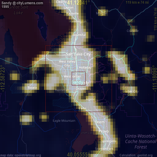
» NASA, Earths city lights 1995
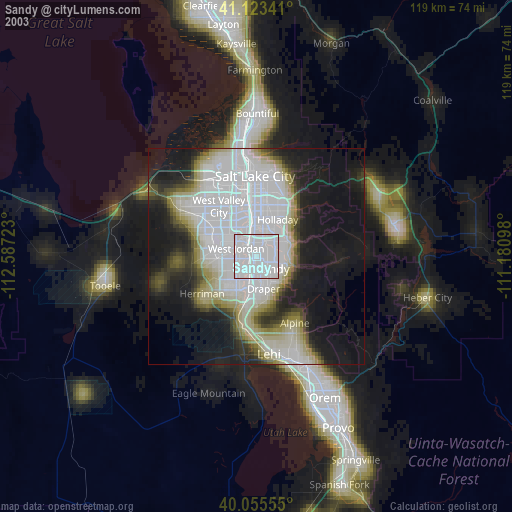
» NASA city lights 2003
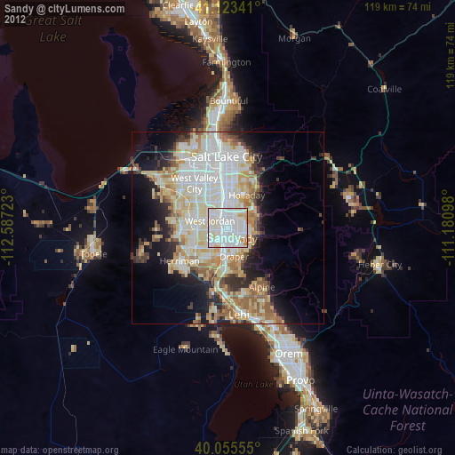
» Earth at Night: Flat Maps 2012, 2016