South Jordan night lights from space
Night Light of South Jordan (Utah) from space (United States) Src. Average luminocity for 10x10km area is 94.6282% and for 50x50km: 37.7372%.
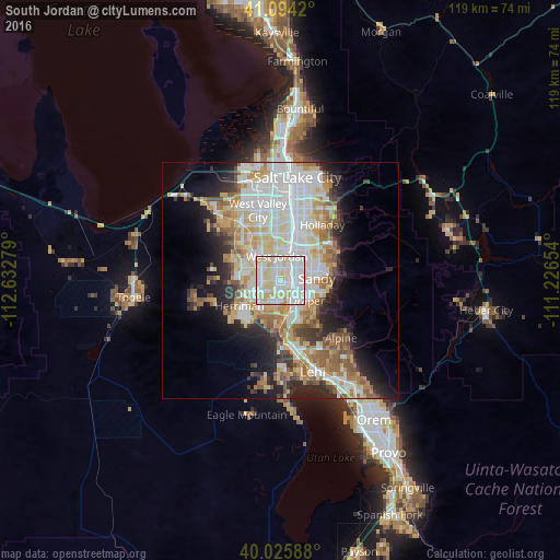
Analysis of South Jordan night lights 2016
Square area 10x10 km:
 34.09%
90-99
40.42%80-89
21.43%70-79
3.9%60-69
0.16%50-59
0%40-49
0%30-39
0%20-29
0%10-19
0%0-9
0%Square area 50x50 km:
9.79%90-99
9.34%80-89
5.99%70-79
4.29%60-69
4.47%50-59
4.19%40-49
2.63%30-39
2.88%20-29
6.12%10-19
8.42%0-9
41.87%Clear (daylight) street map image can be seen on geolist.org.
Map coordinates:
41° 5' 39.1" North, 112° 37' 58" West
40° 33' 43.8" North, 111° 55' 46.8" West
40° 1' 33.2" North, 111° 13' 35.5" West
Some cities around South Jordan sort by population:
• West Jordan
5.3 km =3.3 mi,  351°
351°
• Sandy Hills
7 km =4.3 mi,  72°
72°
• Sandy
5.1 km =3.2 mi,  49°
49°
• Draper
7 km =4.3 mi,  126°
126°
• Riverton
4.5 km =2.8 mi,  190°
190°
• Midvale
6 km =3.7 mi,  24°
24°
• Bluffdale
8.1 km =5 mi, 185°
• White City
5.5 km =3.4 mi,  85°
85°
5781770 (p: 66,648)
Sources (retrieved 2019-11-25):
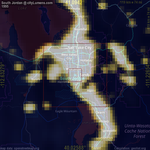
» NASA, Earths city lights 1995
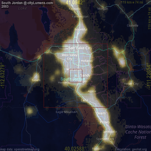
» NASA city lights 2003
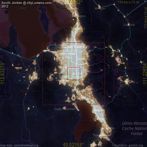
» Earth at Night: Flat Maps 2012, 2016