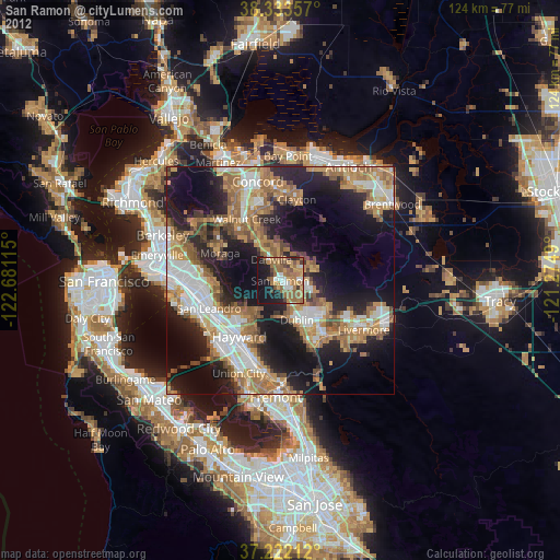
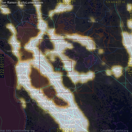
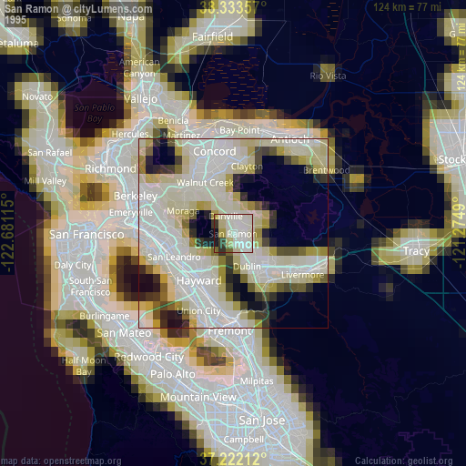
San Ramon night lights from space
Night Light of San Ramon (California) from space (United States) Src. Average luminocity for 10x10km area is 43.9422% and for 50x50km: 37.6294%.
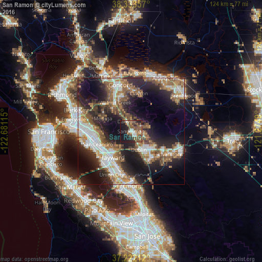
Analysis of San Ramon night lights 2016
Square area 10x10 km:
 5.78%
5.78%90-99
5.95%80-89
0.51%70-79
4.42%60-69
7.65%50-59
19.56%40-49
9.69%30-39
4.08%20-29
14.8%10-19
26.02%0-9
1.53%Square area 50x50 km:
7.05%90-99
6.85%80-89
2.08%70-79
4.62%60-69
6.27%50-59
8.03%40-49
6.08%30-39
4.16%20-29
11.9%10-19
17.44%0-9
25.51%Clear (daylight) street map image can be seen on geolist.org.
Map coordinates:
38° 20' 0.9" North, 122° 40' 52.1" West
37° 46' 47.7" North, 121° 58' 40.9" West
37° 13' 19.6" North, 121° 16' 29.6" West
Some cities around San Ramon sort by population:
• Castro Valley
13.5 km =8.4 mi,  224°
224°
• Dublin
9.4 km =5.8 mi,  156°
156°
• Danville
5 km =3.1 mi,  337°
337°
• Moraga
14.7 km =9.1 mi,  294°
294°
• Alamo
9.1 km =5.7 mi,  328°
328°
• Fairview
12.8 km =8 mi,  207°
207°
• Blackhawk
7.7 km =4.8 mi,  53°
53°
• Saranap
14.5 km =9 mi,  323°
323°
5392593 (p: 76,134)
Sources (retrieved 2019-11-25):
» NASA, Earths city lights 1995
» NASA city lights 2003
» Earth at Night: Flat Maps 2012, 2016