Dublin night lights from space
Night Light of Dublin (California) from space (United States) Src. Average luminocity for 10x10km area is 54.0085% and for 50x50km: 32.5505%.
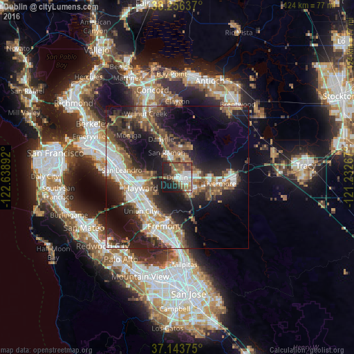
Analysis of Dublin night lights 2016
Square area 10x10 km:
 11.73%
90-99
10.88%80-89
3.57%70-79
4.59%60-69
9.18%50-59
15.99%40-49
5.95%30-39
4.08%20-29
16.84%10-19
17.18%0-9
0%Square area 50x50 km:
6.16%90-99
5.9%80-89
1.77%70-79
3.76%60-69
4.91%50-59
6.35%40-49
5.48%30-39
4.27%20-29
10.29%10-19
17.69%0-9
33.42%Clear (daylight) street map image can be seen on geolist.org.
Map coordinates:
38° 15' 22.9" North, 122° 38' 20.1" West
37° 42' 7.7" North, 121° 56' 8.8" West
37° 8' 37.5" North, 121° 13' 57.6" West
Some cities around Dublin sort by population:
• Hayward
13.3 km =8.3 mi,  253°
253°
• Pleasanton
7 km =4.3 mi,  129°
129°
• San Ramon
9.4 km =5.8 mi,  336°
336°
• Union City
13.9 km =8.6 mi,  211°
211°
• Castro Valley
13.3 km =8.3 mi,  266°
266°
• Danville
14.4 km =8.9 mi, 336°
• Fairview
10 km =6.2 mi, 254°
• Blackhawk
13.4 km =8.3 mi,  10°
10°
5344157 (p: 57,721)
Sources (retrieved 2019-11-25):
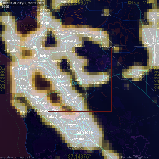
» NASA, Earths city lights 1995
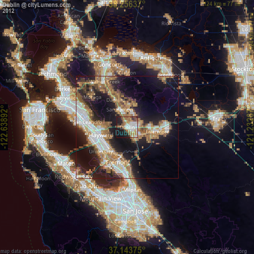
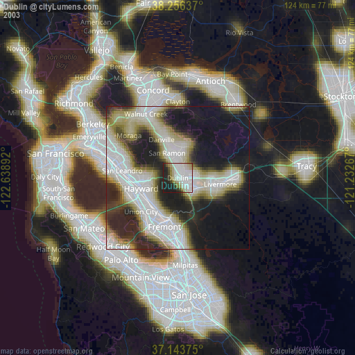
» NASA city lights 2003
» Earth at Night: Flat Maps 2012, 2016