Alamo night lights from space
Night Light of Alamo (California) from space (United States) Src. Average luminocity for 10x10km area is 39.5325% and for 50x50km: 41.6129%.
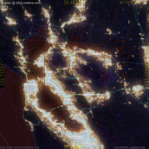
Analysis of Alamo night lights 2016
Square area 10x10 km:
 1.62%
1.62%90-99
3.41%80-89
0.16%70-79
5.84%60-69
12.66%50-59
8.6%40-49
17.21%30-39
7.95%20-29
10.88%10-19
26.3%0-9
5.36%Square area 50x50 km:
8.07%90-99
7.65%80-89
2.22%70-79
5.02%60-69
6.92%50-59
8.67%40-49
6.93%30-39
5.15%20-29
13.91%10-19
16.97%0-9
18.49%Clear (daylight) street map image can be seen on geolist.org.
Map coordinates:
38° 24' 11.9" North, 122° 44' 7.1" West
37° 51' 0.7" North, 122° 1' 55.8" West
37° 17' 34.5" North, 121° 19' 44.6" West
Some cities around Alamo sort by population:
• San Ramon
9.1 km =5.7 mi,  148°
148°
• Walnut Creek
6.9 km =4.3 mi,  335°
335°
• Danville
4.3 km =2.7 mi,  138°
138°
• Lafayette
8.5 km =5.3 mi,  297°
297°
• Moraga
8.7 km =5.4 mi,  258°
258°
• Contra Costa Centre
8.9 km =5.5 mi,  345°
345°
• Waldon
8.7 km =5.4 mi, 346°
• Saranap
5.5 km =3.4 mi,  315°
315°
5322794 (p: 14,570)
Sources (retrieved 2019-11-25):
» Earth at Night: Flat Maps 2012, 2016