San Martin night lights from space
Night Light of San Martin (California) from space (United States) Src. Average luminocity for 10x10km area is 26.6684% and for 50x50km: 11.452%.
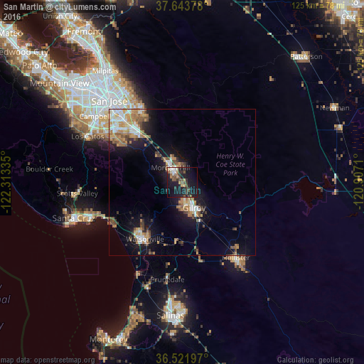
Analysis of San Martin night lights 2016
Square area 10x10 km:
 2.21%
2.21%90-99
2.21%80-89
1.7%70-79
4.08%60-69
2.89%50-59
5.61%40-49
4.76%30-39
5.44%20-29
8.84%10-19
39.46%0-9
22.79%Square area 50x50 km:
1.51%90-99
1.77%80-89
0.85%70-79
2.13%60-69
1.94%50-59
1.72%40-49
1.57%30-39
1.27%20-29
1.79%10-19
8.84%0-9
76.61%Clear (daylight) street map image can be seen on geolist.org.
Map coordinates:
37° 38' 37.6" North, 122° 18' 48.1" West
37° 5' 5.8" North, 121° 36' 36.8" West
36° 31' 19.1" North, 120° 54' 25.6" West
Some cities around San Martin sort by population:
• Watsonville
23.4 km =14.5 mi,  213°
213°
• Gilroy
9.6 km =6 mi,  157°
157°
• Morgan Hill
6.4 km =4 mi,  322°
322°
• Hollister
31.8 km =19.8 mi,  144°
144°
• Soquel
32.6 km =20.3 mi,  250°
250°
• Rio Del Mar
28.8 km =17.9 mi,  243°
243°
• Interlaken
18.5 km =11.5 mi,  216°
216°
• Aptos
28.3 km =17.6 mi, 244°
5392408 (p: 7,027)
Sources (retrieved 2019-11-25):
» Earth at Night: Flat Maps 2012, 2016