Rio Del Mar night lights from space
Night Light of Rio Del Mar (California) from space (United States) Src. Average luminocity for 10x10km area is 17.1006% and for 50x50km: 7.6232%.
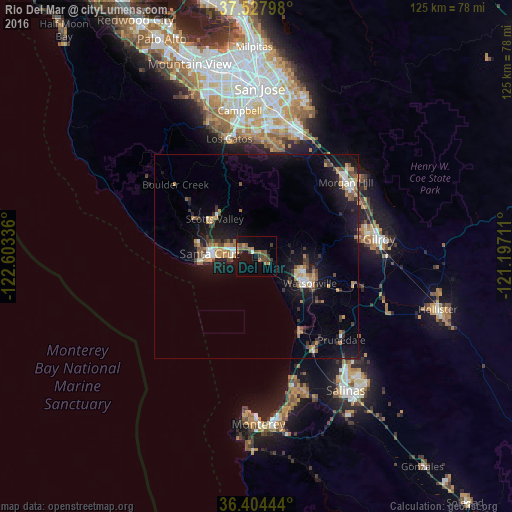
Analysis of Rio Del Mar night lights 2016
Square area 10x10 km:
 0.16%
0.16%90-99
1.14%80-89
0%70-79
2.76%60-69
4.38%50-59
5.52%40-49
4.38%30-39
2.44%20-29
0.32%10-19
18.02%0-9
60.88%Square area 50x50 km:
0.6%90-99
0.87%80-89
0.4%70-79
1.27%60-69
1.21%50-59
0.95%40-49
1.17%30-39
1.47%20-29
1.03%10-19
8.74%0-9
82.29%Clear (daylight) street map image can be seen on geolist.org.
Map coordinates:
37° 31' 40.7" North, 122° 36' 12.1" West
36° 58' 5.8" North, 121° 54' 0.8" West
36° 24' 16" North, 121° 11' 49.6" West
Some cities around Rio Del Mar sort by population:
• Santa Cruz
11.6 km =7.2 mi,  273°
273°
• Watsonville
14.3 km =8.9 mi,  116°
116°
• Live Oak
7.3 km =4.5 mi,  283°
283°
• Scotts Valley
13.7 km =8.5 mi,  312°
312°
• Capitola
4.8 km =3 mi, 279°
• Soquel
5.5 km =3.4 mi,  293°
293°
• Interlaken
14.9 km =9.3 mi,  97°
97°
• Aptos
1 km =0.6 mi,  4°
4°
5387673 (p: 9,216)
Sources (retrieved 2019-11-25):
» Earth at Night: Flat Maps 2012, 2016