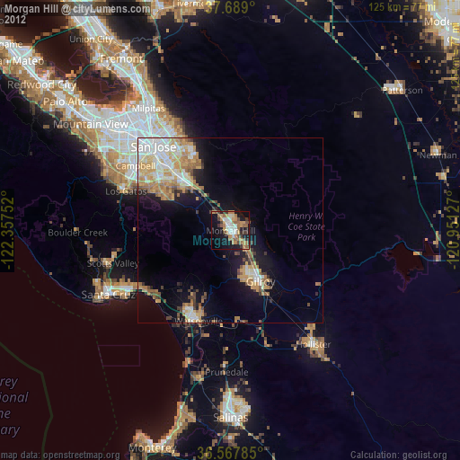
Morgan Hill night lights from space
Night Light of Morgan Hill (California) from space (United States) Src. Average luminocity for 10x10km area is 37.2262% and for 50x50km: 15.091%.
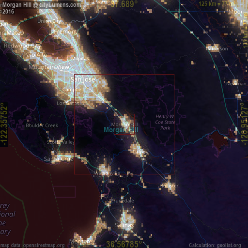
Analysis of Morgan Hill night lights 2016
Square area 10x10 km:
 5.1%
5.1%90-99
5.44%80-89
3.4%70-79
6.46%60-69
4.59%50-59
8.33%40-49
8.33%30-39
3.74%20-29
6.12%10-19
30.61%0-9
17.86%Square area 50x50 km:
2.78%90-99
3.1%80-89
1.38%70-79
2.77%60-69
2.19%50-59
1.79%40-49
1.6%30-39
1.18%20-29
2.06%10-19
8.55%0-9
72.61%Clear (daylight) street map image can be seen on geolist.org.
Map coordinates:
37° 41' 20.4" North, 122° 21' 27.1" West
37° 7' 49.8" North, 121° 39' 15.8" West
36° 34' 4.3" North, 120° 57' 4.6" West
Some cities around Morgan Hill sort by population:
• Watsonville
26.1 km =16.2 mi,  200°
200°
• Gilroy
15.8 km =9.8 mi,  151°
151°
• Los Gatos
30.3 km =18.8 mi,  290°
290°
• Alum Rock
30.3 km =18.8 mi,  329°
329°
• Rio Del Mar
28.3 km =17.6 mi,  230°
230°
• Interlaken
21.1 km =13.1 mi, 199°
• San Martin
6.4 km =4 mi,  142°
142°
• Aptos
27.6 km =17.1 mi, 231°
5374764 (p: 42,948)
Sources (retrieved 2019-11-25):
» Earth at Night: Flat Maps 2012, 2016