Watsonville night lights from space
Night Light of Watsonville (California) from space (United States) Src. Average luminocity for 10x10km area is 31.9058% and for 50x50km: 10.2766%.
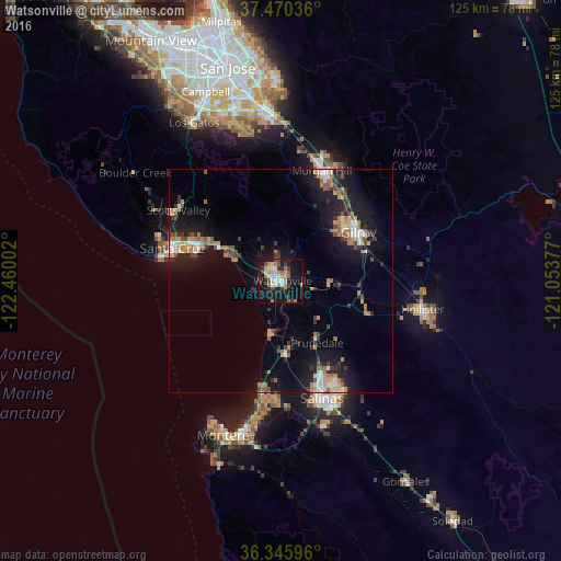
Analysis of Watsonville night lights 2016
Square area 10x10 km:
 3.57%
3.57%90-99
6.66%80-89
1.46%70-79
6.01%60-69
5.19%50-59
3.08%40-49
4.55%30-39
6.17%20-29
1.79%10-19
36.2%0-9
25.32%Square area 50x50 km:
1.05%90-99
1.24%80-89
0.68%70-79
1.7%60-69
1.78%50-59
1.1%40-49
1.42%30-39
1.87%20-29
2.1%10-19
10.27%0-9
76.78%Clear (daylight) street map image can be seen on geolist.org.
Map coordinates:
37° 28' 13.3" North, 122° 27' 36.1" West
36° 54' 36.8" North, 121° 45' 24.8" West
36° 20' 45.5" North, 121° 3' 13.6" West
Some cities around Watsonville sort by population:
• Gilroy
19.8 km =12.3 mi,  57°
57°
• Prunedale
16.8 km =10.4 mi,  152°
152°
• Capitola
18.9 km =11.7 mi,  292°
292°
• Soquel
19.7 km =12.2 mi,  295°
295°
• Rio Del Mar
14.3 km =8.9 mi, 296°
• Interlaken
5 km =3.1 mi,  24°
24°
• Castroville
16.1 km =10 mi,  180°
180°
• Aptos
14.7 km =9.1 mi, 300°
5407529 (p: 53,628)
Sources (retrieved 2019-11-25):
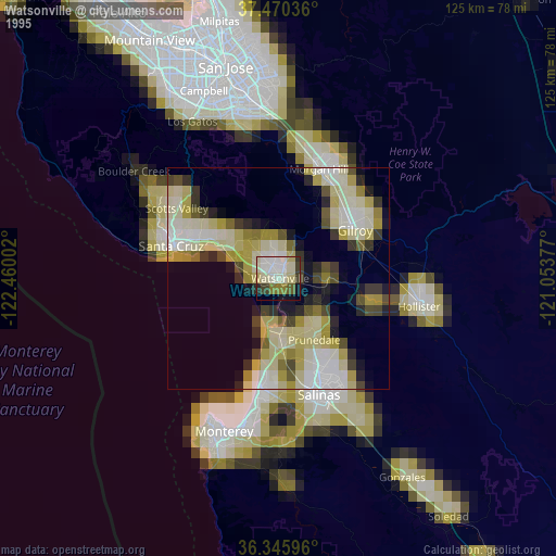
» NASA, Earths city lights 1995
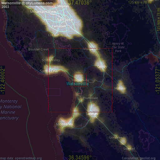
» NASA city lights 2003
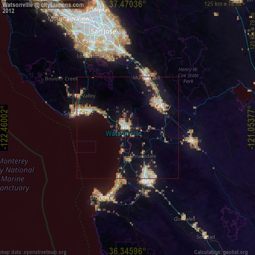
» Earth at Night: Flat Maps 2012, 2016