Canyon Rim night lights from space
Night Light of Canyon Rim (Utah) from space (United States) Src. Average luminocity for 10x10km area is 69.1851% and for 50x50km: 34.1032%.
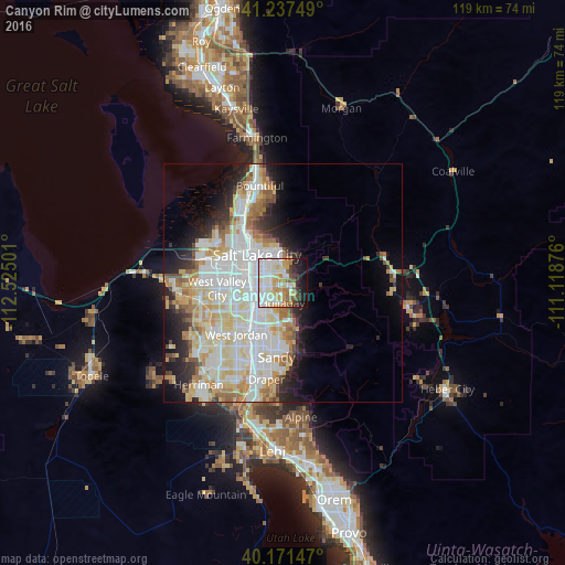
Analysis of Canyon Rim night lights 2016
Square area 10x10 km:
 18.51%
90-99
21.75%80-89
9.25%70-79
11.36%60-69
5.36%50-59
6.01%40-49
4.06%30-39
3.73%20-29
7.14%10-19
12.34%0-9
0.49%Square area 50x50 km:
9.63%90-99
9.44%80-89
5.37%70-79
3.84%60-69
3.73%50-59
2.46%40-49
1.72%30-39
2.18%20-29
4.74%10-19
6.98%0-9
49.9%Clear (daylight) street map image can be seen on geolist.org.
Map coordinates:
41° 14' 15" North, 112° 31' 30" West
40° 42' 23.8" North, 111° 49' 18.8" West
40° 10' 17.3" North, 111° 7' 7.5" West
Some cities around Canyon Rim sort by population:
• Salt Lake City
8.4 km =5.2 mi,  315°
315°
• Millcreek
5 km =3.1 mi,  244°
244°
• Murray
7.1 km =4.4 mi,  231°
231°
• Cottonwood Heights
9.7 km =6 mi,  174°
174°
• Holladay
4.2 km =2.6 mi,  183°
183°
• South Salt Lake
5.8 km =3.6 mi,  283°
283°
• East Millcreek
1.2 km =0.7 mi,  127°
127°
• Mount Olympus
3.7 km =2.3 mi, 129°
5772418 (p: 10,062)
Sources (retrieved 2019-11-25):
» Earth at Night: Flat Maps 2012, 2016