North Salt Lake night lights from space
Night Light of North Salt Lake (Utah) from space (United States) Src. Average luminocity for 10x10km area is 64.3112% and for 50x50km: 24.4829%.
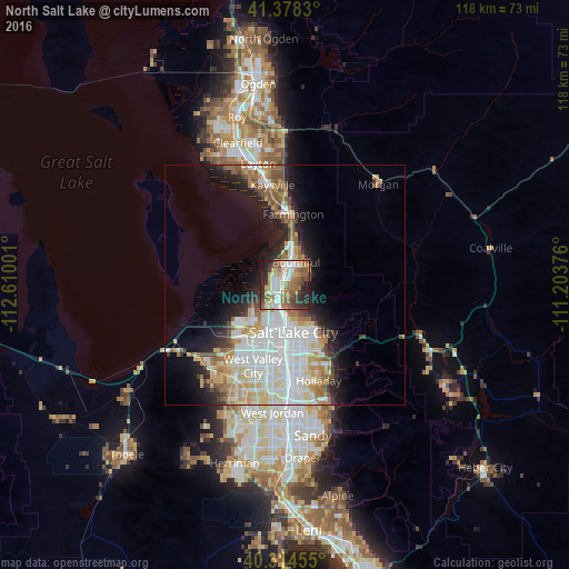
Analysis of North Salt Lake night lights 2016
Square area 10x10 km:
 11.9%
11.9%90-99
14.97%80-89
6.63%70-79
8.5%60-69
15.14%50-59
12.41%40-49
6.12%30-39
8.84%20-29
13.44%10-19
2.04%0-9
0%Square area 50x50 km:
6.48%90-99
5.88%80-89
3.17%70-79
2.71%60-69
3.05%50-59
2.72%40-49
1.78%30-39
1.91%20-29
4.39%10-19
7.77%0-9
60.15%Clear (daylight) street map image can be seen on geolist.org.
Map coordinates:
41° 22' 41.9" North, 112° 36' 36" West
40° 50' 54.8" North, 111° 54' 24.8" West
40° 18' 52.4" North, 111° 12' 13.5" West
Some cities around North Salt Lake sort by population:
• Salt Lake City
9.9 km =6.2 mi,  172°
172°
• Bountiful
5 km =3.1 mi,  25°
25°
• South Salt Lake
14.5 km =9 mi, 173°
• Farmington
14.8 km =9.2 mi,  6°
6°
• Centerville
8.3 km =5.2 mi,  20°
20°
• Woods Cross
2.8 km =1.7 mi, 25°
• Canyon Rim
17.3 km =10.7 mi,  155°
155°
• West Bountiful
5.1 km =3.2 mi,  4°
4°
5779068 (p: 19,796)
Sources (retrieved 2019-11-25):
» Earth at Night: Flat Maps 2012, 2016