Saint Louis Park night lights from space
Night Light of Saint Louis Park (Minnesota) from space (United States) Src. Average luminocity for 10x10km area is 93.4984% and for 50x50km: 65.2951%.
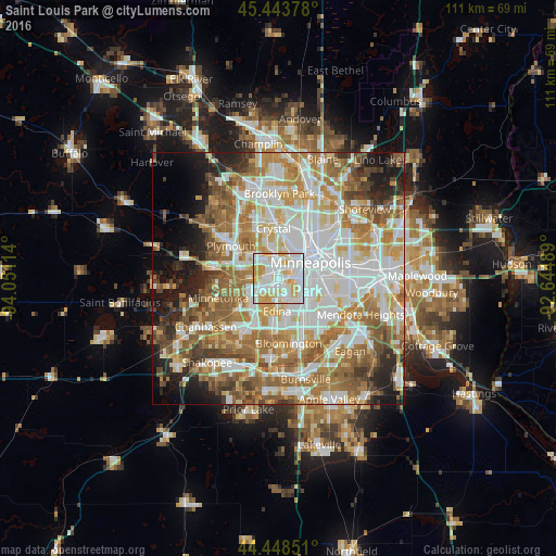
Analysis of Saint Louis Park night lights 2016
Square area 10x10 km:
 36.83%
90-99
34.44%80-89
15.08%70-79
13.65%60-69
0%50-59
0%40-49
0%30-39
0%20-29
0%10-19
0%0-9
0%Square area 50x50 km:
18.2%90-99
15.2%80-89
7.37%70-79
9.03%60-69
12.52%50-59
8.73%40-49
6.19%30-39
3.59%20-29
5.21%10-19
7.09%0-9
6.86%Clear (daylight) street map image can be seen on geolist.org.
Map coordinates:
45° 26' 37.6" North, 94° 3' 4.1" West
44° 56' 53.9" North, 93° 20' 52.8" West
44° 26' 54.6" North, 92° 38' 41.6" West
Some cities around Saint Louis Park sort by population:
• Minneapolis
7.5 km =4.7 mi,  61°
61°
• Edina
6.5 km =4 mi,  181°
181°
• Minnetonka Mills
7.4 km =4.6 mi,  263°
263°
• Richfield
8.9 km =5.5 mi,  144°
144°
• Crystal
9.4 km =5.8 mi,  354°
354°
• Golden Valley
6.8 km =4.2 mi,  359°
359°
• Hopkins
9.4 km =5.8 mi,  253°
253°
• Robbinsdale
9.4 km =5.8 mi,  4°
4°
5045021 (p: 45,250)
Sources (retrieved 2019-11-25):
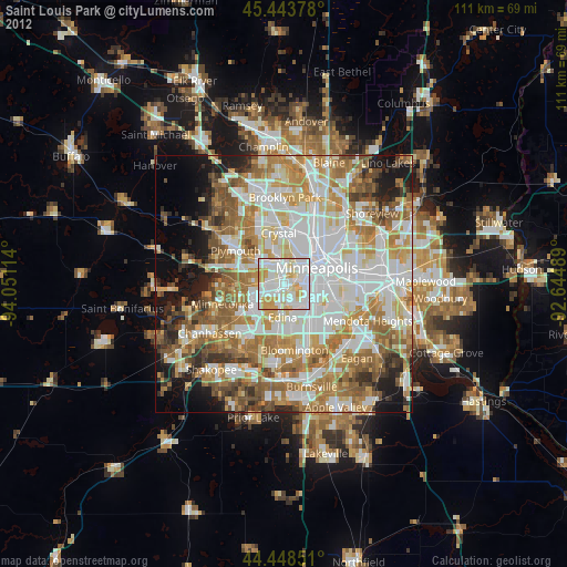
» Earth at Night: Flat Maps 2012, 2016