Edina night lights from space
Night Light of Edina (Minnesota) from space (United States) Src. Average luminocity for 10x10km area is 90.9143% and for 50x50km: 62.6894%.
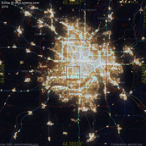
Analysis of Edina night lights 2016
Square area 10x10 km:
 30.95%
90-99
29.84%80-89
16.35%70-79
20%60-69
2.86%50-59
0%40-49
0%30-39
0%20-29
0%10-19
0%0-9
0%Square area 50x50 km:
17.24%90-99
14.39%80-89
7.21%70-79
8.45%60-69
11.95%50-59
8.69%40-49
5.82%30-39
3.86%20-29
5.61%10-19
7.08%0-9
9.71%Clear (daylight) street map image can be seen on geolist.org.
Map coordinates:
45° 23' 8.4" North, 94° 3' 11.1" West
44° 53' 22.9" North, 93° 20' 59.8" West
44° 23' 21.8" North, 92° 38' 48.6" West
Some cities around Edina sort by population:
• Minneapolis
12.1 km =7.5 mi,  34°
34°
• Bloomington
6.8 km =4.2 mi,  143°
143°
• Eden Prairie
10.3 km =6.4 mi,  247°
247°
• Minnetonka Mills
9.2 km =5.7 mi,  308°
308°
• Saint Louis Park
6.5 km =4 mi,  1°
1°
• Richfield
5.3 km =3.3 mi,  97°
97°
• Savage
12.3 km =7.6 mi,  175°
175°
• Hopkins
9.7 km =6 mi,  293°
293°
5025264 (p: 50,138)
Sources (retrieved 2019-11-25):
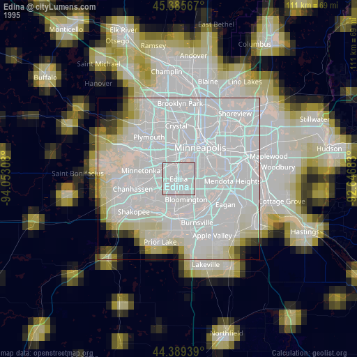
» NASA, Earths city lights 1995
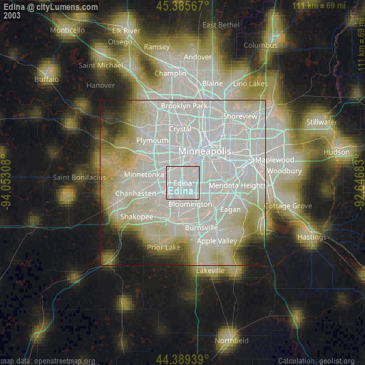
» NASA city lights 2003
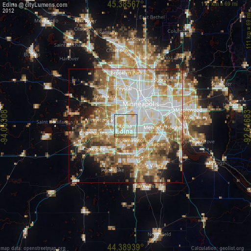
» Earth at Night: Flat Maps 2012, 2016