Town 'n' Country night lights from space
Night Light of Town 'n' Country (Florida) from space (United States) Src. Average luminocity for 10x10km area is 87.25% and for 50x50km: 73.3114%.
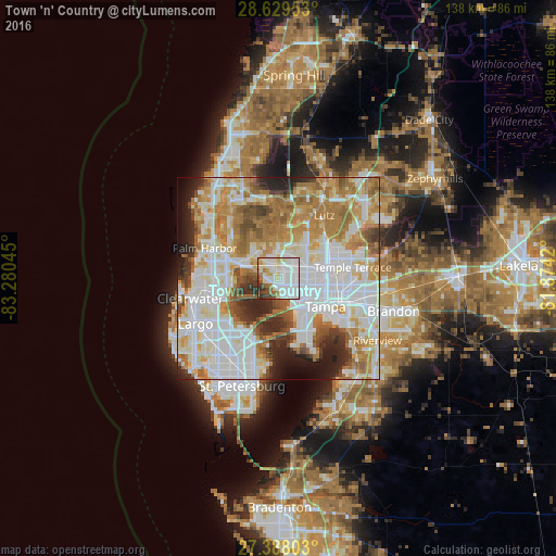
Analysis of Town 'n' Country night lights 2016
Square area 10x10 km:
 41.86%
90-99
25.57%80-89
9.28%70-79
3.6%60-69
6.44%50-59
3.79%40-49
4.36%30-39
4.17%20-29
0.95%10-19
0%0-9
0%Square area 50x50 km:
24.68%90-99
17.49%80-89
7.88%70-79
9.68%60-69
13.83%50-59
5.93%40-49
4.33%30-39
4%20-29
6.54%10-19
3.98%0-9
1.66%Clear (daylight) street map image can be seen on geolist.org.
Map coordinates:
28° 37' 46.3" North, 83° 16' 49.6" West
28° 0' 38.1" North, 82° 34' 38.4" West
27° 23' 16.9" North, 81° 52' 27.1" West
Some cities around Town 'n' Country sort by population:
• Carrollwood Village
8.4 km =5.2 mi,  41°
41°
• Egypt Lake-Leto
7 km =4.3 mi,  83°
83°
• Carrollwood
9.4 km =5.8 mi,  62°
62°
• Citrus Park
7.6 km =4.7 mi,  5°
5°
• Northdale
11.6 km =7.2 mi, 37°
• Westchase
5.9 km =3.7 mi,  327°
327°
• Safety Harbor
11.6 km =7.2 mi,  259°
259°
• Oldsmar
9 km =5.6 mi,  286°
286°
4175538 (p: 78,442)
Sources (retrieved 2019-11-25):
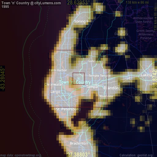
» NASA, Earths city lights 1995
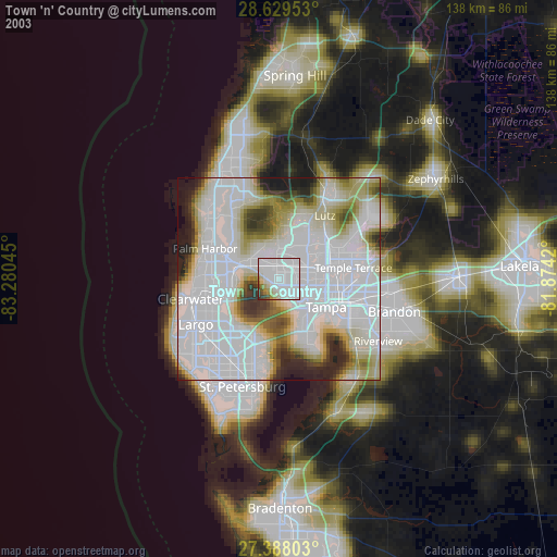
» NASA city lights 2003
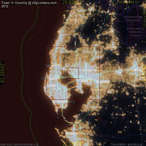
» Earth at Night: Flat Maps 2012, 2016