Aspen Hill night lights from space
Night Light of Aspen Hill (Maryland) from space (United States) Src. Average luminocity for 10x10km area is 81.8571% and for 50x50km: 67.8521%.
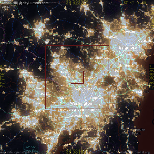
Analysis of Aspen Hill night lights 2016
Square area 10x10 km:
 16.56%
90-99
21.43%80-89
17.53%70-79
18.83%60-69
17.37%50-59
8.28%40-49
0%30-39
0%20-29
0%10-19
0%0-9
0%Square area 50x50 km:
20.03%90-99
15.02%80-89
8.84%70-79
10.77%60-69
11.01%50-59
8.78%40-49
4.78%30-39
4.3%20-29
4.69%10-19
6.44%0-9
5.34%Clear (daylight) street map image can be seen on geolist.org.
Map coordinates:
39° 37' 23.7" North, 77° 46' 34.2" West
39° 4' 46.4" North, 77° 4' 22.9" West
38° 31' 53.9" North, 76° 22' 11.7" West
Some cities around Aspen Hill sort by population:
• Wheaton
4.7 km =2.9 mi,  160°
160°
• North Bethesda
5.6 km =3.5 mi,  225°
225°
• Colesville
6.2 km =3.9 mi,  94°
94°
• Glenmont
3.1 km =1.9 mi,  140°
140°
• North Kensington
5.5 km =3.4 mi,  179°
179°
• Leisure World
2.6 km =1.6 mi,  7°
7°
• Rossmoor
2.7 km =1.7 mi,  3°
3°
• Layhill
2.8 km =1.7 mi,  60°
60°
4347553 (p: 48,759)
Sources (retrieved 2019-11-25):
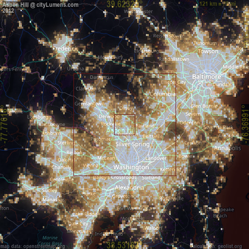
» Earth at Night: Flat Maps 2012, 2016